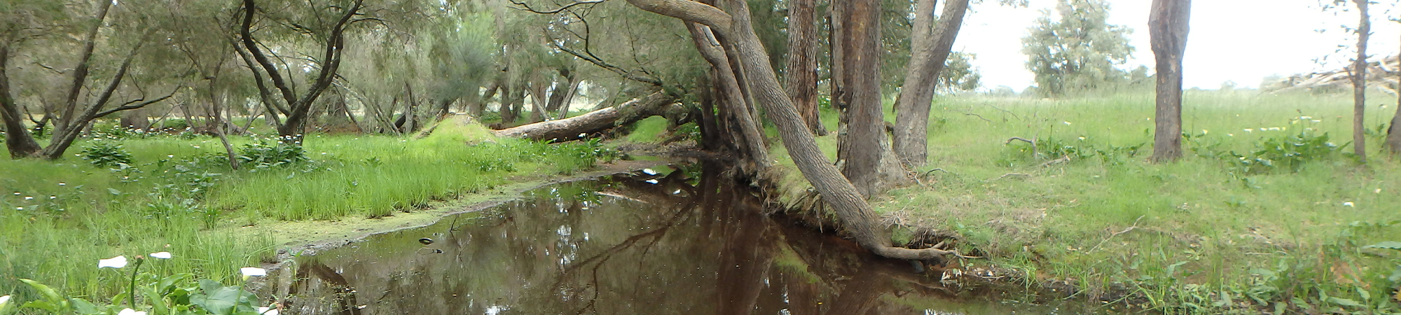
Mary Brook – Station Gully
The Annie Brook, Mary Brook, and Station Gully are small seasonally flowing rivers of the Geographe Bay catchment, located east of Dunsborough in the south-west of Western Australia.
The catchment has a long history of agricultural land use; mainly livestock grazing, and some intensive irrigated agriculture (horticulture and dairy). There is some urban residential land use, predominantly restricted to the lower catchment near the Toby Inlet. There is also a significant amount of residual native forest in the western and south-western upper catchment, within the Yelverton National Park and State Forest, and Haag and Carbunup nature reserves (Hastings 2007 and DAFWA 2008).
Originally the Annie Brook, Mary Brook and Station Gully flowed into the Toby Inlet before discharging into the Geographe Bay. However, in the 1920s they were re-directed through a straightened drain (referred to as Station Gully drain or Annie Brook drain) to discharge directly to Geographe Bay. This work was part of several waterway modifications to drain the lowland areas in order to increase the area available for agriculture (Frazer & Hall 2017).
The Geographe Bay marine park, into which these waterways now discharge, has high ecological and recreational value. For example, it supports extensive seagrass meadows that serve important ecological functions, and vital habitat for marine biota. These seagrass ecosystems are particularly sensitive to poor water quality and excess nutrients. The bay is also extensively for recreation by the local community and important for tourism (DoW 2010).
The Toby Inlet (into which these waterways once flowed) also has ecological and social value, providing habitat for fish and migratory birds as well as a recreational area for residents and tourists (Frazer & Hall 2017). However, the modifications to the hydrology of the landscape combined with increased nutrient and organic loads have negatively affected its health. Consequently, algal blooms, low dissolved oxygenation and nuisance odours are now a regular occurrence during summer (DoW 2010).
The outlet of the Annie Brook, Station Gully and Mary Brook is adjacent to the Toby Inlet and still maintains some connection, through a gated culvert. The option to increase connectivity with the Toby Inlet has recently been investigated as a potential way to improving the health of the Toby Inlet (Frazer & Hall 2017). However, the effectiveness of this would depend highly on the quality of water discharging from the Station Gully, Annie Brook, and Mary Brook.
Annie Brook, Station Gully and Mary Brook have their own intrinsic ecological, social, and cultural values (Hastings 2007). However, the hydrological modifications and agricultural intensification have resulted in many stressors to the rivers; mainly including those associated with increased nutrient load and degradation of the protective riparian zones. These generally lead to poor water quality, loss of biodiversity and ecological function. This is not only problematic for the waterways themselves, but also to the receiving environments. Consequently, the Annie Brook, Mary Brook and Station Gully system has been identified as an ‘intervention’ area under the Vasse Wonnerup and Geographe Bay Water Quality Improvement Plan (DoW 2010), and targeted for the implementation of best-practices for agriculture and riparian zone management.
REFERENCES:
Department of Agriculture and Food Western Australia (DAFWA) 2008, Land use in Western Australia version 7, Department of Agriculture and Food Western Australia, South Perth.
Department of Water (DoW) 2010, Vasse-Wonnerup Wetlands and Geographe Bay: Water Quality Improvement Plan, Western Australian Department of Water, Perth, 203 pp.
Frazer J & Hall J 2017, Reconnecting Toby Inlet: options for increasing water circulation in Toby Inlet to improve water quality – a Revitalising Geographe Waterways project, Water Science Technical Series report no. 80, Department of Water and Environmental Regulation, Western Australia.
Hastings K 2007, Geographe Waterways Values, unpublished internal report, Geocatch 2007.