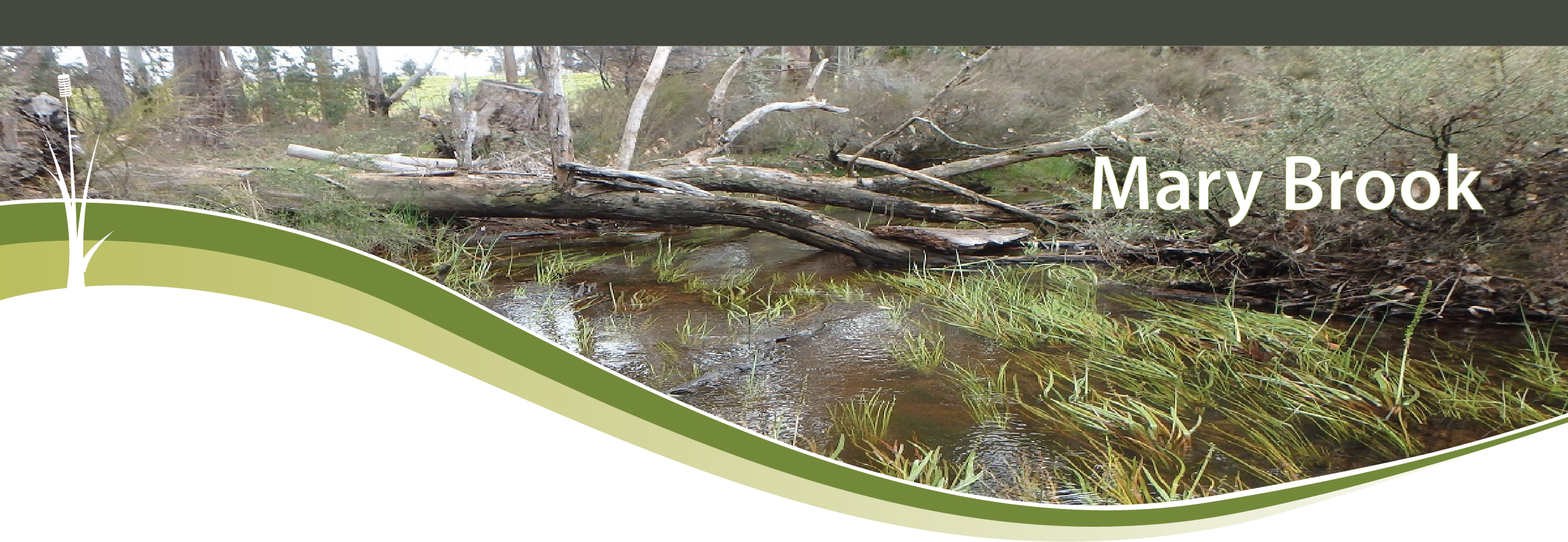
Mary Brook
Basin : Busselton Coast
Catchment : Mary Brook - Station Gully
The condition of the Mary Brook site (MB11MARY1) was assessed between 9 and 10 October 2017, over a 150 m length of stream. The Mary Brook is part of the Annie Brook, which is within the Geographe bay catchment.
The assessment was conducted using standard methods from the South West Index of River Condition. Measures chosen for this assessment included fish and crayfish, macroinvertebrates, aquatic habitat, water quality (dissolved oxygen, temperature, electrical conductivity, and pH logged over 24h, and colour, alkalinity, turbidity and nutrients), fringing vegetation, channel morphology, erosion, connectivity, local land use and flow.
Condition summary

Semi-permanent pool on Mary Brook – stock watering point
The site supports the expected range of macroinvertebrate, and native fish and crayfish species for the area, however abundances were low and no juveniles were detected. Notably, no exotic aquatic fauna were found. The ecosystem appears to be in generally good condition, with abundant and diverse in-stream habitat, a generally intact fringing vegetation zone (supported by stock-exclusion fencing) and no obvious signs of active erosion. The site includes a stock watering point, which presents a permanent water habitat for aquatic fauna.
The regions waterways are at risk from drying climate and abstraction, and nutrient enrichment from agriculture. Whilst management practices at this site are offering a high level of protection, more work is needed to improve protection of downstream reaches.
Future work should focus on elucidating possible recruitment issues in the reach, identifying of summer refuge habitats in the system in order to focus protection efforts, and stock exclusion/riparian restoration throughout.
River setting
The Mary Brook is a small seasonal river, with a meandering plane-bed river channel, within the broad, low-gradient landform of the Swan Coastal Plain.
The catchment has a long history of agricultural use, which has had waterways in this area through vegetation clearing and increase nutrient inputs. Land use in the broader catchment was predominantly grazing for cattle, with some remnant vegetation, and irrigated seasonal horticulture. The prevailing land use at the site was a horticulture and grazing for cattle and sheep, with some remnant vegetation.
Aquatic habitat
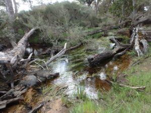
habitat of the Mary Brook – October 2017
Characterised by meandering channel approximately 7 m wide, with a depth ranging from 0.25 to 1 m deep, and flow ranging from 0 to 1 m/s. Under higher flow conditions the morphology would offer a wide range of flow conditions, with wide shallow banks offering rest areas.
The site offered a range of habitats types including channel, small pool weir pool (stock access point), and riffle habitat. Structural habitat included a very dense abundance of woody debris in a wide range of sizes, dense aquatic macrophyte coverage (80% coverage by triglochin spp), and riparian vegetation draped into the water as habitat along around 10-50% of the bank length.
Flow and connectivity
The majority of the brook dries out over summer with only a few small sections retaining water. Sampling was undertaken under receding flow conditions; the site was still flowing at the time of sampling.
A small artificially maintained weir pool (stock access point) exists at the site, which generally retains water over summer. At the time of sampling this created a vertical and horizontal jump of > 30 cm. This obstacle is likely passable by fish under higher flows, but becomes a barrier under lower flows.
Vegetation
The majority of the fringing zone at this site had been fenced off from stock access, with a designated stock access point access point in the middle of the site. The vegetation within the streamside zone (first 10 m on each bank) included a ground, shrub and tree layers, but all with reduced cover compared to that expected under natural conditions. Teatree, marri, and peppermint trees were the dominant species. The ground layer included native sedges and grasses with some exotic grasses. The protection from stock offered by the fencing supported healthy re-growth of riparian revegetation, which provided coverage of the banks and shade to the aquatic habitat. The banks had minimal erosion with excellent structural integrity, supported by shallow and deep-rooted vegetation.
In the broader adjacent zone (10-100 m from the river) the vegetation was significantly reduced on the both banks, and consisted of grasses and crops, with scattered remnant trees, with a land use of grazing and horticulture.
Water quality
All water quality parameters were within naturally expected ranges during the 24 hour sampling period (SWIRC guidelines). Notably, dissolved oxygen was high, and nutrient concentrations were below the ANZECC (2000) guidelines values. This is a positive result, as nutrient enrichment is a recognised issue in the Annie Brook wider (DoW 2010).
Fish and crayfish
The fish and crayfish community was as expected for this site, and comprised of three native fish and two native crayfish, with no exotic species. All individuals were in good condition, however no juveniles were recorded, and the abundances were relatively low. Further sampling would be needed to determine if there are recruitment issues in this system. A list of species is provided at the bottom of the page, click on the images to learn more about each species.
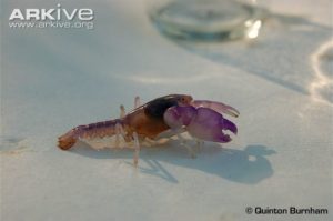
Engaewa reducted (Augusta burrowing crayfish) – image Quinton Burnham
The presence of smooth marron (Cherax cainii), which is relatively immobile and cannot tolerate dry conditions, or prolonged periods of low dissolved oxygen (Morgan et al. 1998), indicates that a permanent-water refuge with sufficient water quality to support the aquatic biota community over summer exists at the site or nearby.
Additionally, the critically endangered Dunsborough burrowing crayfish, Engaewa reducta, is identified as a value of the wider Annie Brook catchment system, in which the Mary Brook lies (DoW 2010, Hastings 2007). Although this species was not recorded in this study (it does not live within the main stream channel), it is an important ecological value to consider for the broader area. They are sensitive to hydrological change and soil disturbance, and therefore likely affected by impacts to aquatic ecosystems, and therefore an important management consideration.
Species found in subcatchment
Aquatic macroinvertebrates
The macroinvertebrate community indicates the site has relatively good ecological integrity. Twenty-three taxa were found with many sensitive taxa such as water mites, stoneflies, caddis flies and mayflies. Total abundance was dominated (almost 70%) by Chironomidae species, mainly from the genera Cricotopus, Tanytarsus and Chironomus, which tend to be common in nutrient enriched conditions or warmer waters and low (Burton and Pitt 2002, Bunn et al. 1986). There was a high abundance (20% of total population) of the blackfly larvae
Austrosimulium sp. which requires relatively silt-free fast-flowing waters (MDFRC 2013). Additionally, four EPT taxa (Ephemeroptera, Plecoptera and Trichoptera) were found (including the endemic stonefly Newmanoperla exigua). A greater diversity and abundance of EPT taxa, usually indicate good water quality and overall better river health as they are typically more sensitive to water pollution and have more specific habitat requirements (Barbour et al. 1999, WRM 2009).


