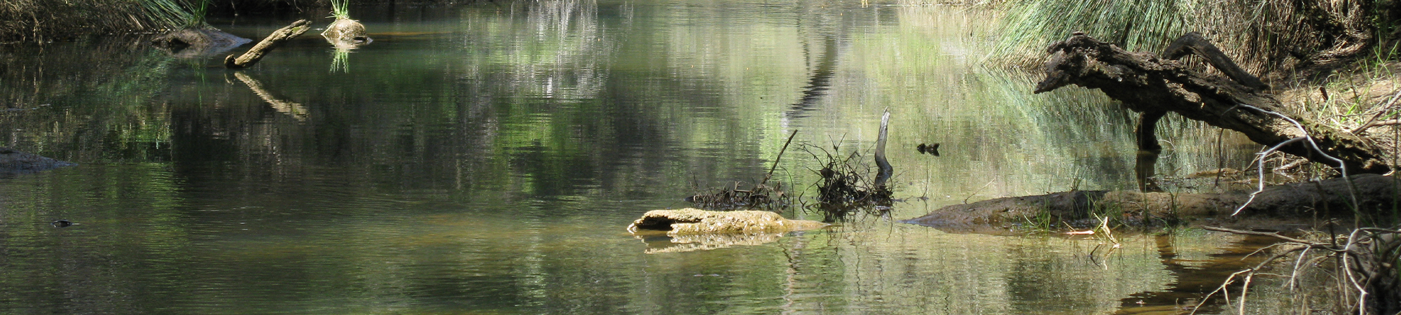
Harvey River
The Harvey River catchment is 1921 km2 and is around 100 km south of Perth.
It includes the Harvey River and three main tributaries (Drakes (Waroona Drain), Samson and Logue brooks) which all originate on the Darling Plateau and flow down the scarp to the Swan Coastal Plain. On the coastal plain, the Harvey Diversion Drain conveys water from the Harvey River to the ocean. Downstream from the confluence with the diversion drain, water in the Harvey River and the three main tributaries flows into the Peel-Harvey Estuary.
The Harvey River is approximately 80 km in length from the headwaters to the confluence with the estuary.
Based on data from Australian Bureau of Agriculture and Resource Economics and Sciences (ABARES, 2018), land use in the catchment of the Harvey River system is almost 50 % state forest, with agricultural land uses (intensive, irrigated and grazing) running along the foothills of the Darling Scarp and into the Swan Coastal Plain. Other land uses present include cropping, plantations, urbanisation and mining.
Land use in the catchment of the main branch of the Harvey River is similar to the river system as a whole, with agriculture (grazing, intensive and irrigated agriculture) covering three quarters of the catchment. The remaining area is used for cropping, infrastructure, urban and state forest (ABARES 2018).
Flows in the Harvey River system are highly regulated, with seven large dams that are managed for different purposes:
- Harvey Dam, Logue Brook Dam, Waroona Dam (on Drakes Brook), Drakes Brook Dam and Wokalup Creek Pipehead Dam – water is used to supply the Harvey and Waroona irrigation districts, managed by Harvey Water (the trading name for the South West Irrigation Management Cooperative Ltd) Releases of water from the dams are managed in accordance with the Harvey-Waroona Irrigation Water Resource Management Operating Strategy (WRMOS) (Strategen 2013).
- Stirling Dam (on the Harvey River) and Samson Dam – water is used to supply the Integrated water supply scheme (IWSS), managed via the Stirling and Samson WRMOS.
The two dams on the main branch of the Harvey River, Stirling Dam and Harvey Dam, were completed in 1948 and 2002 respectively, although flow regulation dates back to 1916 at the Harvey Weir (close to the site of the current Harvey Dam).
There is limited information about the Harvey River’s natural flow regime before the dams were built. Streamtec (2001) used a catchment area-rainfall model to estimate flow prior to the arrival of European settlers. They suggest that the natural flow regime of the upper Harvey River was perennial and would have followed a seasonal pattern, with the highest mean monthly flow in August (12 700 ML/month) and the lowest in March (514 ML/month).
In the river between the Stirling and Harvey dams, the flow regime has varied over time based on water use. Between 1948 and 2001 water was used for irrigation resulting in large volumes being released from the dam in summer to meet irrigation needs, and for recreational canoeing between 1979 and the late 1990s. In 2001 the primary use changed from irrigation to public water supply, and pipes were used to transport water, leading to a reduction in summer flows (although occasional high volumes were still released for irrigation) – for further details and graphs see White and Storer (2012). Currently the flow regime in this part of the river is managed via the Stirling and Samson WRMOS and includes releases to maintain the aquatic ecosystem (environmental water releases, EWRs).
Around 3 km downstream from Harvey Dam flows are directed into the Harvey Diversion Drain (at a structure known as Larsen’s Cut) which was built in the 1930s to manage flooding. however water from an irrigation pipeline is released into the river at Larsen’s Cut. The flow regime in the river below Harvey Dam and below Larsen’s Cut is managed via the Harvey-Waroona Irrigation WRMOS (Strategen 2013) – see Background and rational for details. A dynamic approach is taken by Harvey Water in relation to releases at both the dam and Larsen’s Cut, where if levels are running low (even when no release is required) water will be released to encourage flow, whilst still remaining compliant with requirements (Harvey Water, 2017).
In future, flow in the Harvey River system is expected to reduce. Climate modelling predicts that mean annual runoff in the Harvey to Preston region will reduce by between 7 and 40% in 2030 compared to the period 1975-2007 (scenarios C-wet and C-dry respectively, CSIRO 2009).
REFERENCES:
ABARES & DPRID (Australian Bureau of Agriculture and Resource Economics and Sciences & Department of Primary Industries and Regional Development) 2018, Catchment Scale Land Use Mapping for Western Australia 2018, Australian Bureau of Agriculture and Resource Economics and Sciences and Department of Primary Industry and Regional Development, Western Australia. https://data.gov.au/dataset/d897e165-46a3-4f3b-a2f2-b348ac06ddfe (accessed on 21 November 2018).
CSIRO (Commonwealth Scientific and Industrial Research Organisation) 2009, Surface water yields in south-west Western Australia, a report to the Australian Government from the CSIRO south-west Western Australia sustainable yields project, CSIRO Water for a Healthy Country Flagship, Australia.
Harvey Water 2017, Triennial Water Resource Statement Harvey Water to Department of Water and Environmental Regulation, report period October 2016 to September 2017. Harvey Waroona Irrigation Scheme. Harvey Water, Western Australia.
Strategen 2013, Harvey-Waroona Irrigation Water Resource Management Operating Strategy. Prepared for Harvey Water, Western Australia.
Streamtec 2001, Ecological water requirements of the Harvey River: Stirling Dam to New Harvey Dam, Report AT 10/00, Streamtec Pty Ltd, Nedlands.
White G & Storer T 2012, Assessment of ecological health and environmental water provisions in the Harvey River (between Stirling Dam and Harvey Reservoir), February to May 2011, WST 44, Department of Water, Perth.