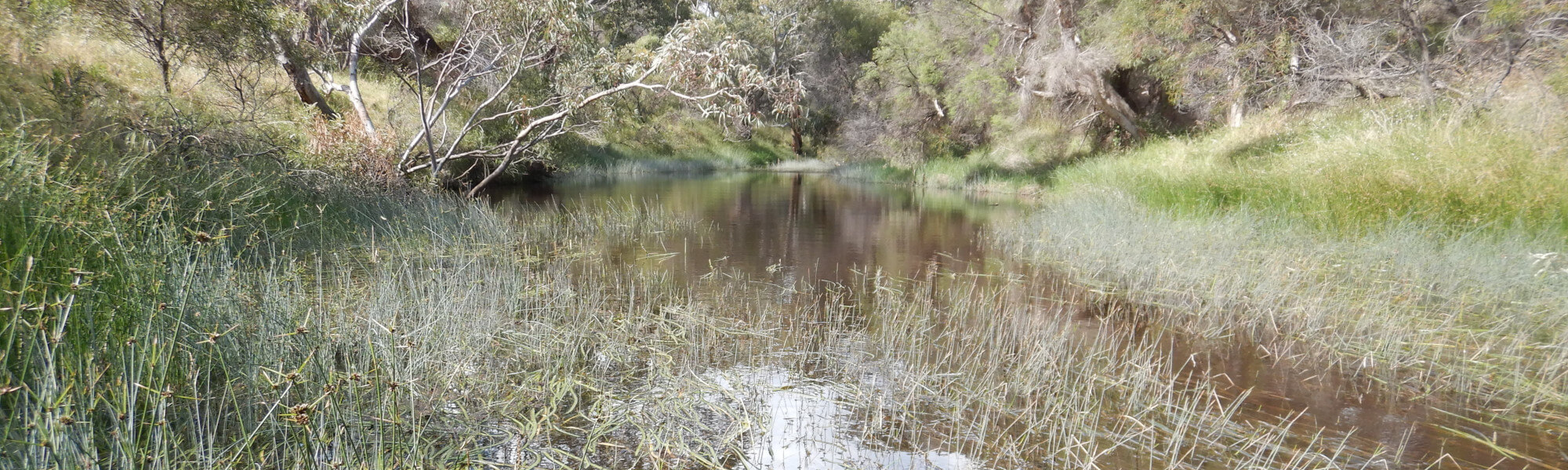
Hill River - Indian Ocean Drive
Basin : Moore-Hill rivers
Catchment : Hill River
The condition of the Indian Ocean Drive site (site code: HR2HILL1, site reference: 6170043), in the lower Hill River, was assessed between 27 and 28 October 2021, over a 100-m length of stream. A site a few hundred meters downstream was previously assessed, under code HR-01/6171290, in 2008 as part of a national assessment of river condition – view report here.
River condition in 2021 was assessed as part of the Healthy Rivers Program (Healthy Rivers), using standard methods from the South West Index of River Condition (SWIRC). The SWIRC incorporates field and desktop data from the site and from the broader catchment. Field data collected included the following indicators, assessed over about a 100 m length of stream:
- Aquatic biota: fish and crayfish community information (abundance of native and exotic species across size classes, general reproductive and physical condition)
- Water quality: dissolved oxygen, temperature, specific conductivity, and pH (logged in-situ over 24 hours) as well as laboratory samples for colour, alkalinity, turbidity and nutrients
- Aquatic habitat: e.g. water depth, substrate type, presence of woody debris and detritus, type and cover of macrophytes and draping vegetation
- Physical form: channel morphology, bank slope and shape, bioconnectivity (barriers to migration of aquatic species), erosion and sedimentation
- Fringing zone: width and length of vegetation cover within the river corridor and lands immediately adjacent, structural intactness of riparian and streamside vegetation
- Hydrology: measures of flow (velocity) at representative locations (compared against data from stream gauging stations within the system)
- Local land use: descriptions of local land use types and activities (compared against land use mapping information for the catchment)
Search using the site code or site reference in the Department of Water and Environmental Regulation’s Water Information Reporting (WIR) system to find data for this site and nearby sampling points (flow, surface water quality, groundwater monitoring, department’s meteorological data). See also the Bureau of Meteorology website for additional meteorological data for the area.
Condition summary
A summary of aquatic biota detected over the different sampling events is provided in the section below. For other site data, please contact the department’s River Science team (please reference the site code and sampling dates).
Fish and crayfish
The species expected to occur here (listed below) are based on species reported from the previous assessment in 2008, from other studies conducted elsewhere in the wider river catchment and our understanding of fish behaviour and movements within river systems. As differences in habitat within a reach naturally influence species distributions, and variability in methods between sampling programs can affect the species caught, this list is only indicative.
Note: collection of fauna from Western Australia’s inland aquatic ecosystems requires a license from the Department of Primary Industries and Regional Development (DPIRD) and also the Department of Biodiversity, Conservation and Attractions (DBCA). All species collected must be reported to these agencies as part of license conditions.
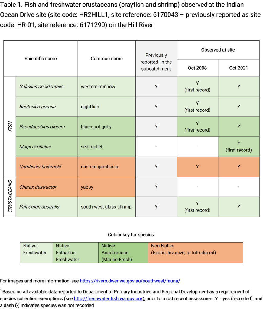
Only fish and freshwater crustaceans (crayfish and shrimp) that typically inhabit river channels are targeted by the standard SWIRC sampling methods. However, where other species were caught and/or observed (e.g., turtles, rakali, frogs and tadpoles), these are mentioned below.