King River - Billa Boya Gauging Station
Basin : Albany Coast
Catchment : Kalgan River
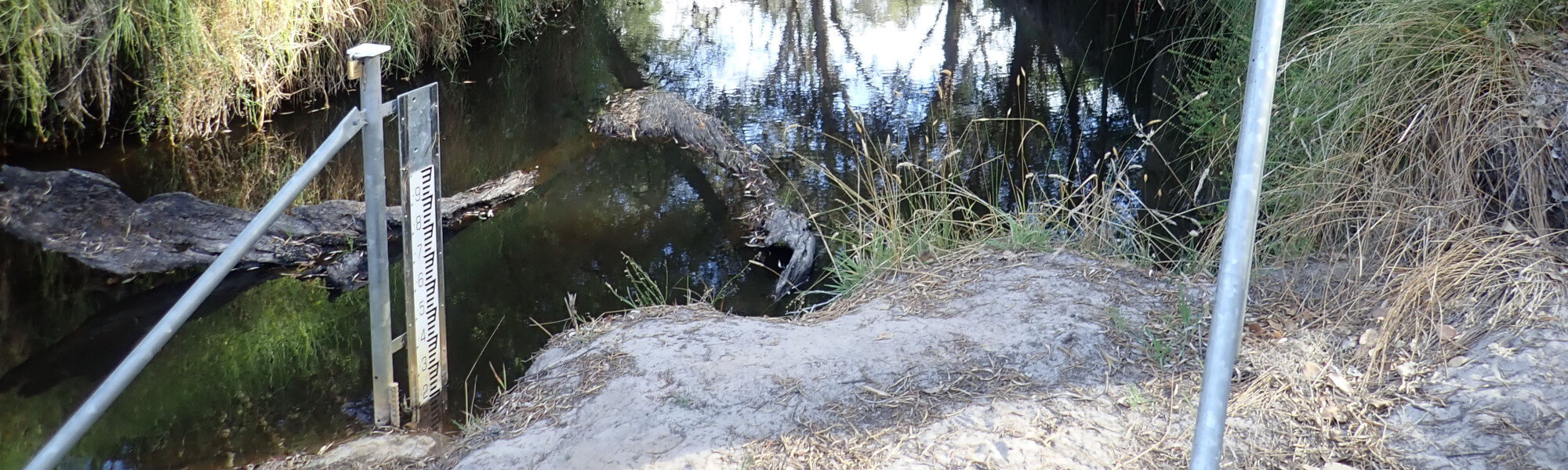
River condition at the Billa Boya Gauging site (site code: KR58ESTYU1, site reference: 6021700, previously reported as site code: KR, site reference: 602014) on the King River has been assessed as part of the Healthy Rivers Program (Healthy Rivers), using standard methods from the South West Index of River Condition (SWIRC). The SWIRC incorporates field and desktop data from the site and from the broader catchment. Field data collected include the following indicators, assessed over approximately a 100 m length of stream:
-
- Aquatic biota: fish and crayfish community information (abundance of native and exotic species across size classes, general reproductive and physical condition) and macroinvertebrates
- Water quality: dissolved oxygen, temperature, specific conductivity, and pH (logged in-situ over 24 hours) as well as laboratory samples for colour, alkalinity, turbidity and nutrients
- Aquatic habitat: e.g. water depth, substrate type, presence of woody debris and detritus, type and cover of macrophytes and draping vegetation
- Physical form: channel morphology, bank slope and shape, bioconnectivity (barriers to migration of aquatic species), erosion and sedimentation
- Fringing zone: width and length of vegetation cover within the river corridor and lands immediately adjacent, structural intactness of riparian and streamside vegetation
- Hydrology: measures of flow (velocity) at representative locations (compared against data from stream gauging stations within the system)
- Local land use: descriptions of local land use types and activities (compared against land use mapping information for the catchment)
This is the second assessment of this site using the SWIRC methods. Assessments are listed below:
- 2020 – summer (March 10–11): Healthy Rivers
- 2008 – summer (December 17–18): Healthy Rivers
Other departmental data: The Billa Boya Gauging Station site is about 350 m downstream of the Billa Boya Reserve gauging station (site reference: 602014). The gauging station is owned by the department and has been in operation since 1992.
Search on the site code or site reference in the Department of Water and Environmental Regulation’s Water Information Reporting (WIR) system to find data for this site and nearby sampling points (flows, surface water quality, groundwater monitoring, department’s meteorological data). See also the Bureau of Meteorology website for additional meteorological data for the area.
Condition summary
A complete condition summary for this site has not yet been published. Please contact the department’s River Science team for site data (please provide the site code and sampling dates).
The previous assessment of this site in 2008 was conducted in December, towards the beginning of the dry season. December is within the Noongar season of Birak, which is generally when the rains start to subside, and the warm weather starts to take hold.
The assessment which was conducted in 2008 was part of a national assessment of river condition – view report here.
The image below indicates conditions at the time of sampling in March 2020, towards the end of the dry season. March is within the Noongar season of Bunuru, which is generally the driest and hottest part of the year. Further images are provided in the gallery at the bottom of the page to show general site conditions.
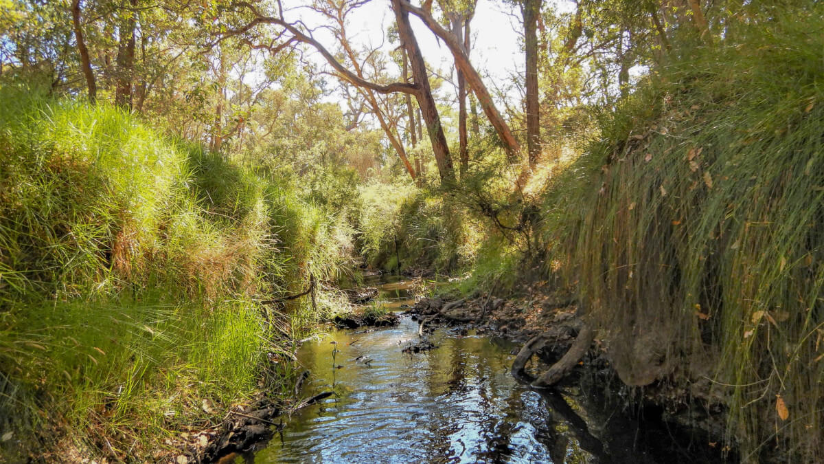
King River, March 2020
An overview of aquatic species found at the site is provided in the next section.
Species found in subcatchment
Native Species
- Balston's pygmy perchNannatherina balstoni
- Black breamAcanthopagrus butcheri
- Blue-spot gobyPseudogobius olorum
- Common jollytailGalaxias maculatus
- KoonacCherax preissii
- NightfishBostockia porosa
- Pouched lampreyGeotria australis
- Smooth marronCherax cainii
- South-west glass shrimpPalaemon australis
- Western minnowGalaxias occidentalis
- Western pygmy perchNannoperca vittata
Species found at the site
Fish and crayfish
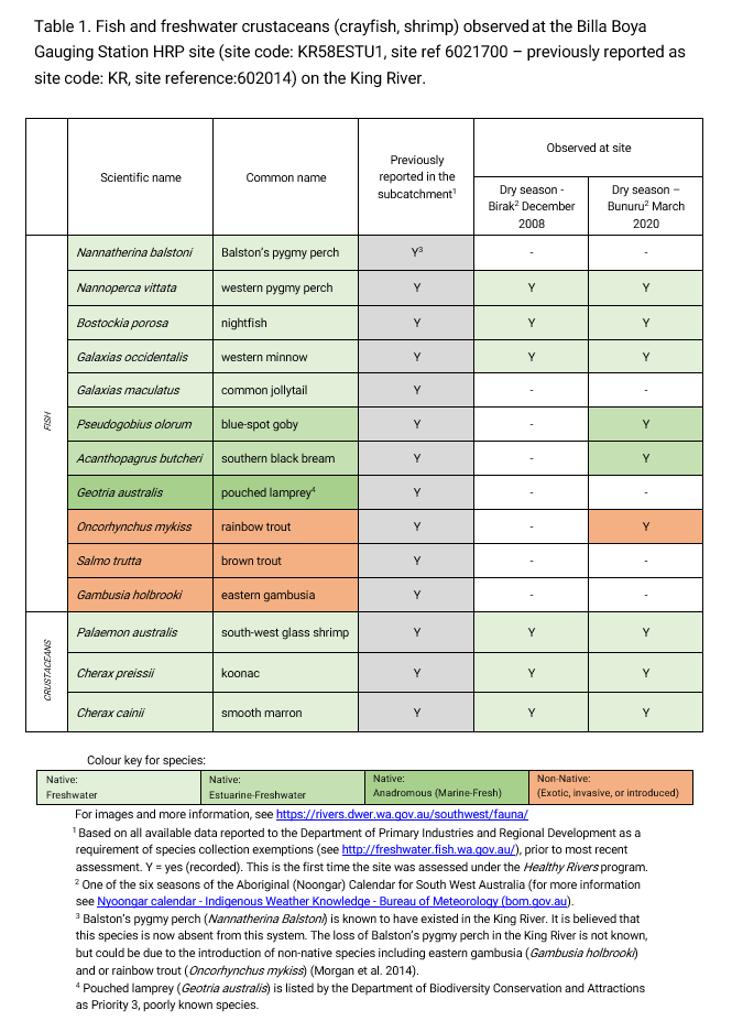
Nine species of fish and crayfish were found at this site in the March 2020 assessment. This includes three native freshwater fish (western pygmy perch, nightfish and western minnow), two native estuarine-freshwater fish species (black bream and blue-spot goby), three native freshwater crustaceans (south-west glass shrimp, koonac and smooth marron) and one non-native fish species (rainbow trout).
Dominant fish species at this site were the blue-spot goby and western pygmy perch. A range of size classes including juveniles were recorded for the western pygmy perch with a couple of the larger fish showing nuptial (breeding) colours. Similarly, there was evidence of many gravid (pregnant) nightfish at this site. This section of the King River is able to provide suitable habitat for each of these species as well as support successful recruitment.
The common jollytail was not found in either of the 2008 or 2020 assessments conducted by the department. However, this species of fish was observed in other studies conducted by Murdoch University. The common jollytail generally migrates between estuaries and freshwater parts of rivers to complete their life cycle. They typically breed in estuaries and return to freshwater during spring, however the reverse is true for populations inhabiting in the Jerdacuttup and Oldfield Rivers where adults move upstream to spawn. As such, the reason for the absence of the common jollytail in the Healthy Rivers assessment is likely due to the species being in other parts of the system at the time of sampling.
Balston’s pygmy perch was formally known as the King River Perchlet as it was first discovered in the King River (formally described in 1906). Unfortunately, it is now believed that the Balston’s pygmy perch is now extirpated from this system. Although the reason for the absence of this species in the King River is not known, it is thought to be due to the introduction of non-native species including eastern gambusia and or rainbow trout (Beatty et al. 2014).
One non-native fish species was found in the March 2020 assessment. Rainbow trout are stocked annually by the Department of Primary Industries and Regional Development. The purpose of stocking trout is for recreational fishing in inlands water. The annual locations and quantities of trout stocking can be found here.
Note: collection of fauna from inland aquatic ecosystems across Western Australia requires a license from the Department of Primary Industries and Regional Development (DPIRD) and also the Department of Biodiversity, Conservation and Attractions (DBCA). All species collected must be reported to these agencies as part of license conditions.
Other aquatic fauna
Although not directly targeted as part of the Healthy Rivers assessment, a quacking frog was recorded. This frog species is endemic to the South West.
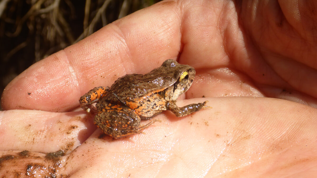
Quacking frog (Crinia georgiana), March 2020
For more info on these and other aquatic species, please see the River Science fauna page here.


