Marbelup Brook - Elleker Gauging Station
Basin : Denmark Coast
Catchment : Marbelup Brook
River condition at the Elleker gauging station site (site code: MB61MARB1, site reference: 6031573) on Marbelup Brook has been assessed as part of the Healthy Rivers Program (Healthy Rivers), using standard methods from the South West Index of River Condition (SWIRC). The SWIRC incorporates field and desktop data from the site and from the broader catchment. Field data collected include the following indicators, assessed over approximately a 100 m length of stream:
-
- Aquatic biota: fish and crayfish community information (abundance of native and exotic species across size classes, general reproductive and physical condition)
- Water quality: dissolved oxygen, temperature, specific conductivity, and pH (logged in-situ over 24 hours) as well as laboratory samples for colour, alkalinity, turbidity and nutrients
- Aquatic habitat: e.g. water depth, substrate type, presence of woody debris and detritus, type and cover of macrophytes and draping vegetation
- Physical form: channel morphology, bank slope and shape, bioconnectivity (barriers to migration of aquatic species), erosion and sedimentation
- Fringing zone: width and length of vegetation cover within the river corridor and lands immediately adjacent, structural intactness of riparian and streamside vegetation
- Hydrology: measures of flow (velocity) at representative locations (compared against data from stream gauging stations within the system)
- Local land use: descriptions of local land use types and activities (compared against land use mapping information for the catchment)
This is the first assessment of this site using the SWIRC methods. At this time no previous assessments of river ecology had been reported.
Assessments are listed below:
- 2020 – summer (10-11 Mar): Healthy Rivers
Other departmental data: The river health site is located in the vicinity of the departments Elleker flow gauging station (site reference: 603001), which has been in operation since 2012.
Search on the site code or site reference in the Department of Water and Environmental Regulation’s Water Information Reporting (WIR) system to find data for this site and nearby sampling points (flows, surface water quality, groundwater monitoring, the department's meteorological data). See also the Bureau of Meteorology website for additional meteorological data for the area.
Condition summary
A complete condition summary for this site has not yet been published. Please contact the department’s River Science team for site data (please provide the site code and sampling dates).
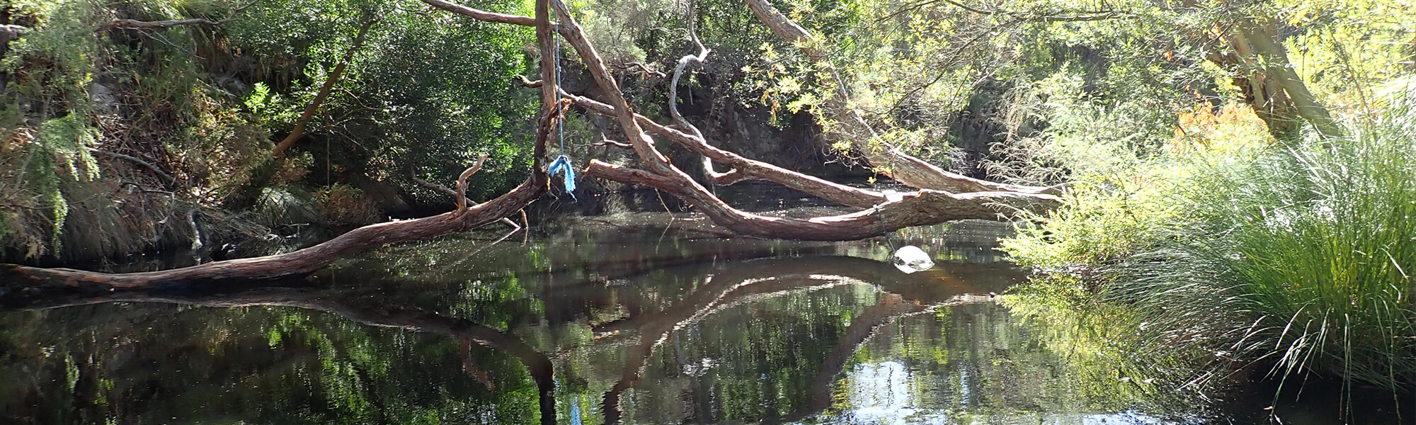
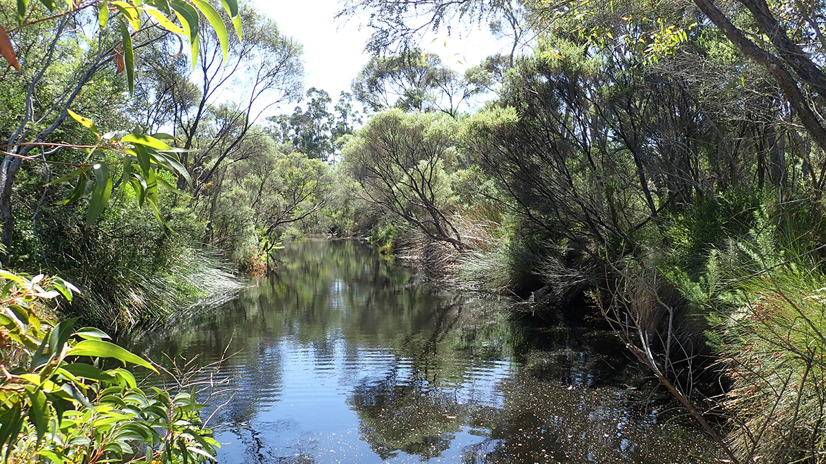
The image below indicates conditions at the time of sampling in March, towards the end of the dry season. Further images are provided in the gallery at the bottom of the page to show general site conditions.
An overview of aquatic species found at the site is provided in the next section.
Marbelup Brook, March 2020
Species found in subcatchment
Native Species
Exotic Species
Species found at the site
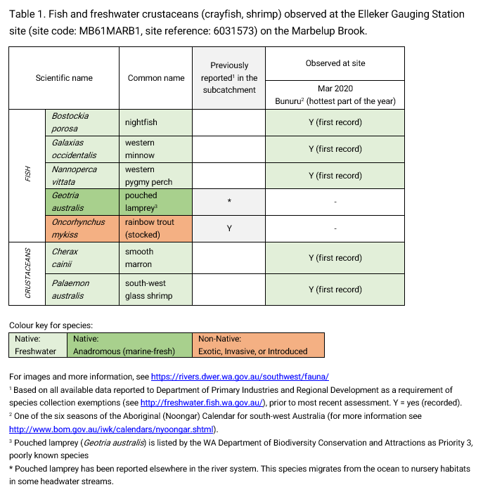
Fish and crayfish
Five native species were recorded at this site in March 2020, this includes three native fish (nightfish, western minnow, western pygmy perch) and two native crustaceans (smooth marron, south-west glass shrimp). One introduced non-native fish, the rainbow trout, was previously recorded in the subcatchment but was not found in this study.
The pouched lamprey is expected in the subcatchment, however this species typically migrates in short periods around peak winter flows and only in high flow years (which is largely outside of the assessment periods). Outside of the short migration periods, lamprey are unlikely to enter traps and their absence from most SWIRC assessments is not a significant concern.
Pouched lamprey are categorised as Priority 3 species (Poorly-known) under the Biodiversity Conservation Act 2016 (Western Australia). Priority 3 refers to possibly threatened species where data is insufficient to assess threatening processes that could affect them, also noting that this species is not expected to be under imminent threat based on available data.
Only fish and freshwater crustaceans (crayfish and shrimp) that typically inhabit river channels are targeted by the standard SWIRC sampling methods. However, where other species were caught and/or observed (e.g., turtles, rakali-native water rats, tadpoles), these are mentioned in the Other aquatic fauna section below.
Note: collection of fauna from inland aquatic ecosystems across Western Australia requires a license from the Department of Primary Industries and Regional Development (DPIRD) and also the Department of Biodiversity, Conservation and Attractions (DBCA). All species collected must be reported to these agencies as part of license conditions.
Other aquatic fauna
Although not targeted by collection methods a south-western long necked turtle (Chelodina colliei) was recorded during March 2020 assessments.
For more information on this species or other aquatic species, please see the River Science fauna page here


