Murray – Serpentine rivers
A description of the Murray River system is provided at the basin level.
The Serpentine River is around 40km south of perth, and travels approximately 110 km from the Darling Plateau in the east (where it is impounded by the Serpentine Dam), flowing downstream through the Serpentine National Park (Darling Scarp), and across the Swan Coastal Plain, before discharging to the Peel Estuary.
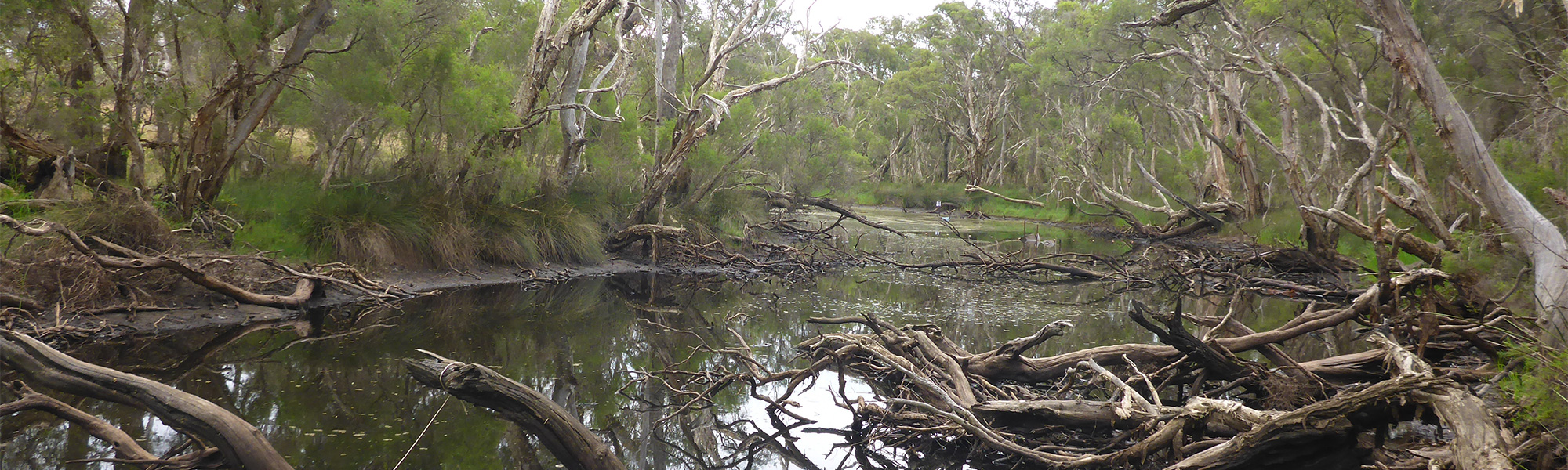
The river through the Plateau and Scarp regions forms cascades, falls, river pools and riffles, however it is now a highly modified drainage channel through much of the Swan Coastal Plain below Lowlands Reserve. Before discharging to the Peel Estuary, the river runs through the Lower Serpentine lakes system.
Land use in Serpentine River catchment is generally undisturbed to the east of the Darling Scarp, with state forest and national park being the main uses. Downstream (west) of the scarp the land has been mostly cleared for agriculture; generally grazing but with some intensive and irrigated agriculture (including sheep feedlots, poultry farms and piggeries). There is also considerable (and expanding) urban land use to the north, which is drained by the Peel Main Drain and enters the Serpentine River around 30 km upstream of its confluence with the Peel Estuary.
Many tributaries of the Serpentine River on the Swan Coastal Plain are deeply incised drainage channels which were modified to drain the low-lying lands on the coastal plain to support agriculture in the region. The major exception to this is the Lowlands Reserve which is a 13.12 km2 area of uncleared remnant vegetation straddling the Serpentine River within the Swan Coastal Plain.
The south west of Western Australia has seen a marked reduction in rainfall, and concomitant decline in streamflow, associated with changing climate. For the period 2008 to 2015 the average rainfall (Karnet weather station) has declined 10% in comparison to the 1975 to 2007 average but this has resulted in a 58% reduction in inflows to the dams. Prior to the mid 1970’s it was common to see inflows of 100 to 140 GL/year but over the past decade combined dam inflows have rarely been above 20 GL/year (DOW 2017).
The Serpentine Dam has affected the flow regime for the river, with flows now artificially controlled through dam releases at two locations – above Serpentine Falls on the Scarp and downstream at Halls Road. In all but the driest years, releases keep the river connected to the downstream end of the Lowlands Reserve, however maintaining this regime is increasingly difficult given reduced inflows to the dam and reduced groundwater recharge due to an increasingly drying climate. The Serpentine Falls presents a natural barrier to fish movement and the two dams (pipe-head and main) on the Darling Plateau are an artificial barrier to fish movement in the upper catchment.
Summaries of river health at sites across the Murray and Serpertine catchments can be accessed by clicking on the links at the bottom of this page or by using the interactive map provided (if this is available on your device). A regional summary of river health is also available on the Healthy Estuaries WA website.
REFERENCES:
Department of Water and Environmental Regulation 2017, Managing Releases for the Serpentine River, Serpentine River Allocation Statement, November 2017. Department of Water and Environmental regulation, Perth.
Sites
- Buchanans Drain
- Hotham River – Hotham River Nature Reserve
- Hotham River – Popanyinning
- Hotham River – Pumphreys Bridge
- Hotham River – Ranford Pool
- Lower Nambeelup Brook
- Lower Nambeelup Brook 2
- Lower Punrak Drain
- Lower Punrak Drain 2
- Murray-Marrinup Brook
- Serpentine River – Birriga Drain
- Serpentine River – Dog Hill
- Serpentine River – Downstream Peel Main Drain
- Serpentine River – Lowlands
- Serpentine River – Lowlands Road
- Serpentine River – Rapids Road
- Serpentine River – Ruperts
- Serpentine River – Summerfield Road
- Williams River – Boraning Reserve
- Williams River – Quindanning