King Creek - Bettys Beach Road
Basin : Albany Coast
Catchment : King Creek
River condition at the Bettys Beach Road site (site code: KC1KING1, site reference: 6021699) on the King Creek has been assessed as part of the Healthy Rivers Program (Healthy Rivers), using standard methods from the South West Index of River Condition (SWIRC). The SWIRC incorporates field and desktop data from the site and from the broader catchment. Field data collected include the following indicators, assessed over approximately a 100 m length of stream:
-
- Aquatic biota: fish and crayfish community information (abundance of native and exotic species across size classes, general reproductive and physical condition)
- Water quality: dissolved oxygen, temperature, specific conductivity, and pH (logged in-situ over 24 hours) as well as laboratory samples for colour, alkalinity, turbidity and nutrients
- Aquatic habitat: e.g. water depth, substrate type, presence of woody debris and detritus, type and cover of macrophytes and draping vegetation
- Physical form: channel morphology, bank slope and shape, bioconnectivity (barriers to migration of aquatic species), erosion and sedimentation
- Fringing zone: width and length of vegetation cover within the river corridor and lands immediately adjacent, structural intactness of riparian and streamside vegetation
- Hydrology: measures of flow (velocity) at representative locations (compared against data from stream gauging stations within the system)
- Local land use: descriptions of local land use types and activities (compared against land use mapping information for the catchment)
This is the first assessment of this site using the SWIRC methods. At this time no previous assessments of river ecology had been reported.
Assessments are listed below:
- 2020 – summer (12-13 Mar): Healthy Rivers
Other department data: Search on the site code or site reference in the Department of Water and Environmental Regulation’s Water Information Reporting (WIR) system to find data for this site and nearby sampling points (flows, surface water quality, groundwater monitoring, the department's meteorological data). See also the Bureau of Meteorology website for additional meteorological data for the area.
Condition summary
A complete condition summary for this site has not yet been published. Please contact the department’s River Science team for site data (please provide the site code and sampling dates).
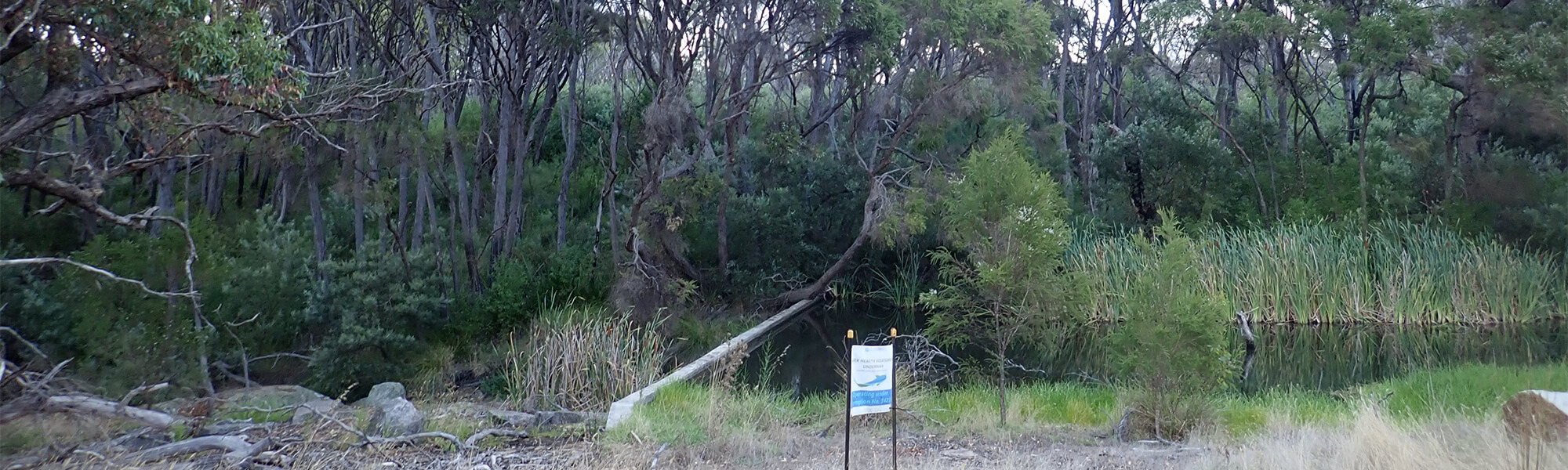
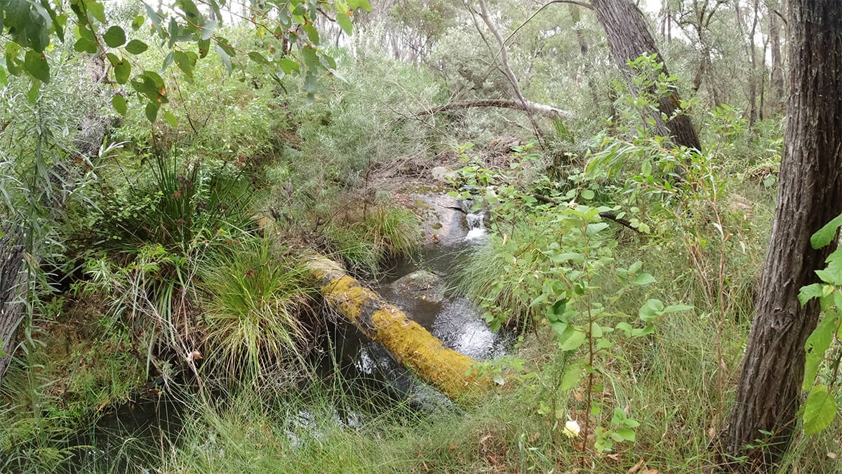
The image below indicates conditions at the time of sampling in March, towards the end of the dry season. Further images are provided in the gallery at the bottom of the page to show general site conditions.
An overview of aquatic species found at the site is provided in the next section.
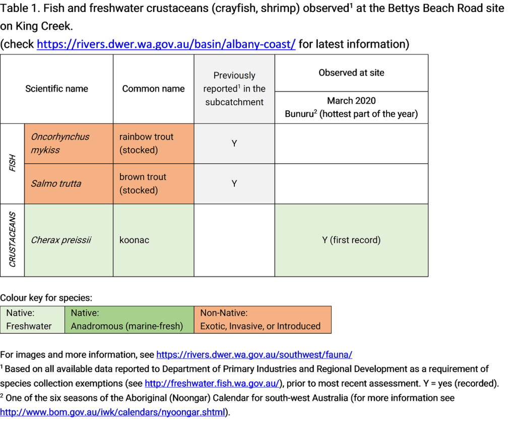
King Creek, March 2020
Species found in subcatchment
Native Species
Exotic Species
Species found at the site
Fish and crayfish
One native crayfish species, the koonac, was recorded at this site in the March 2020 assessments. Further assessments are required to determine true species richness in this catchment. Notably no non-native species were recorded during assessments.
Although not recorded during assessments the non-native brown trout and rainbow trout were historically stocked in the catchment for recreational fishing. These species typically don’t breed in South West river systems (due to unfavourable conditions) and are not expected to maintain a viable population. However they are highly predatory and can impact populations of native aquatic species.
Only fish and freshwater crustaceans (crayfish and shrimp) that typically inhabit river channels are targeted by the standard SWIRC sampling methods. However, where other species were caught and/or observed (e.g., turtles, rakali-native water rats, tadpoles), these are mentioned in the Other aquatic fauna section below.
Note: collection of fauna from inland aquatic ecosystems across Western Australia requires a license from the Department of Primary Industries and Regional Development (DPIRD) and also the Department of Biodiversity, Conservation and Attractions (DBCA). All species collected must be reported to these agencies as part of license conditions.
Other aquatic fauna
Although not targeted by collection methods, tadpoles were recorded upstream of the weir at the assessment site during the March 2020 assessment.
For more information on other aquatic species, please see the River Science fauna page here.


