Yakamia Creek - Lower King Road
Basin : Albany Coast
Catchment : Kalgan River
River condition at the Lower King Road site (site code: KR5YAKA1, site reference: 6021696) on Yakamia Creek has been assessed as part of the Healthy Rivers Program (Healthy Rivers), using standard methods from the South West Index of River Condition (SWIRC). The SWIRC incorporates field and desktop data from the site and from the broader catchment. Field data collected include the following indicators, assessed over approximately a 100 m length of stream:
-
- Aquatic biota: fish and crayfish community information (abundance of native and exotic species across size classes, general reproductive and physical condition) and macroinvertebrates
- Water quality: dissolved oxygen, temperature, specific conductivity, and pH (logged in-situ over 24 hours) as well as laboratory samples for colour, alkalinity, turbidity and nutrients
- Aquatic habitat: e.g. water depth, substrate type, presence of woody debris and detritus, type and cover of macrophytes and draping vegetation
- Physical form: channel morphology, bank slope and shape, bioconnectivity (barriers to migration of aquatic species), erosion and sedimentation
- Fringing zone: width and length of vegetation cover within the river corridor and lands immediately adjacent, structural intactness of riparian and streamside vegetation
- Hydrology: measures of flow (velocity) at representative locations (compared against data from stream gauging stations within the system)
- Local land use: descriptions of local land use types and activities (compared against land use mapping information for the catchment)
This is the first assessment of this site using the SWIRC methods. At this time no previous assessments of river ecology had been reported.
Assessments are listed below:
- 2020 – summer (March 18–19): Healthy Rivers
Other departmental data: The Lower King Road site is about 3.2 km downstream of the Watti gauging station (site reference: 602601), which is located in the upper section of the Yakamia Creek subcatchment. This gauging station is owned by the department and has been in operation since 2018.
Search on the site code or site reference in the Department of Water and Environmental Regulation’s Water Information Reporting (WIR) system to find data for this site and nearby sampling points (flows, surface water quality, groundwater monitoring, department’s meteorological data). See also the Bureau of Meteorology website for additional meteorological data for the area.
Condition summary
A complete condition summary for this site has not yet been published. Please contact the department’s River Science team for site data (please provide the site code and sampling dates).
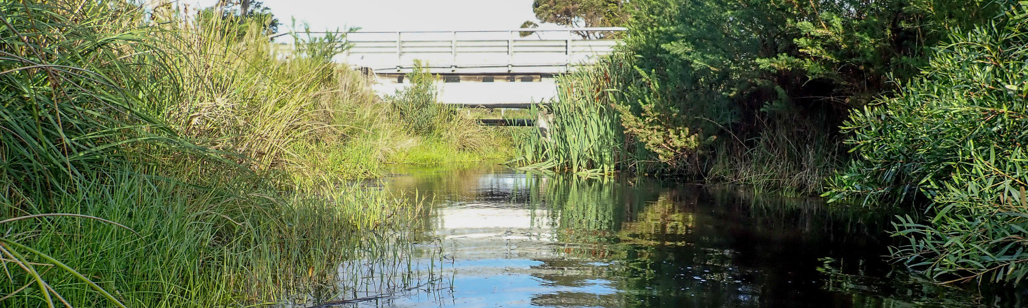
The image below indicates conditions at the time of sampling in March, towards the end of the dry season. March is within the Noongar season of Bunuru, which is generally the driest and hottest part of the year. Further images are provided in the gallery at the bottom of the page to show general site conditions.
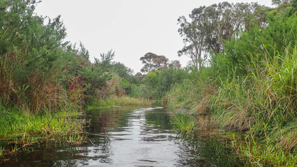
YAKAMIA CREEK, MARCH 2020
An overview of aquatic species found at the site is provided in the next section.
Species found in subcatchment
Species found at the site
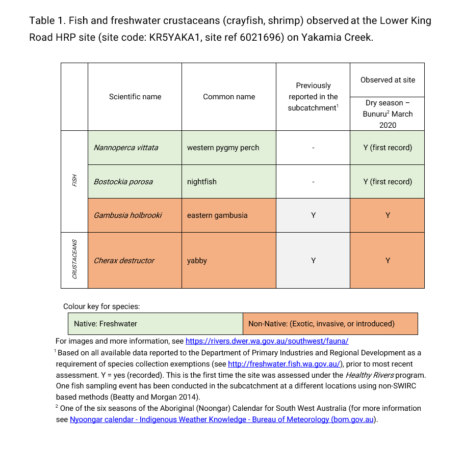
Fish and crayfish
Four species of fish and crayfish were recorded at this site in the March 2020 assessment. This includes two native freshwater fish (western pygmy perch and nightfish), one non-native freshwater fish (gambusia) and one non-native freshwater crustacean (yabby).
Eastern gambusia (juvenile and adults) dominated the catch during the March 2020 Lower King Road assessment. This suggests the creek is under stress, likely due to suboptimal water conditions (low dissolved oxygen and possibly other water quality conditions related to prevailing land use. Note: only standard physicochemical parameters and nutrients were assessed in this study) and also habitat loss due to clearing of vegetation through the stream corridor and historical modifications (deepening and straightening) to the Creek. The presence of juveniles suggests successful recruitment and suitable habitat for this species. Eastern gambusia are common throughout many south-west systems and tend to thrive in disturbed or degraded systems and are tolerant of low dissolved oxygen concentrations. They are also known to attack the fins of native fish and compete for food and habitat.
As this was the first time this site had been sampled, the species expected to occur here are based on species found elsewhere within the wider subcatchment (previous sampling occurred by Morgan and Beatty in 2014). Western pygmy perch and nightfish were not detected by Morgan and Beatty (2014). Although found in low abundances, it is encouraging to see the two native freshwater fish species present at the Lower King Road site given the suboptimal conditions in the creek.
Note: collection of fauna from inland aquatic ecosystems across Western Australia requires a license from the Department of Primary Industries and Regional Development (DPIRD) and also the Department of Biodiversity, Conservation and Attractions (DBCA). All species collected must be reported to these agencies as part of license conditions.
Other aquatic fauna
Two south-western snake-necked turtle were captured at this assessment site.
Yakamia was formerly known as Yakinup, which translates to ‘the place of the long-necked tortoise’ in the Menang-Noongar language. South-western snake-necked turtles have not been recorded in any other studies. However, one was recorded in Yakamia Creek during an excavation event during 2013 in the upper section of the catchment. Residents around Ulster Road have also commented on seeing snake-necked turtles in the area (Janicke and Janicke 2015). The presence of the two turtles from the March 2020 assessment is encouraging and highlights the potential for re-establishment if the identified stressors to the systems are mitigated.
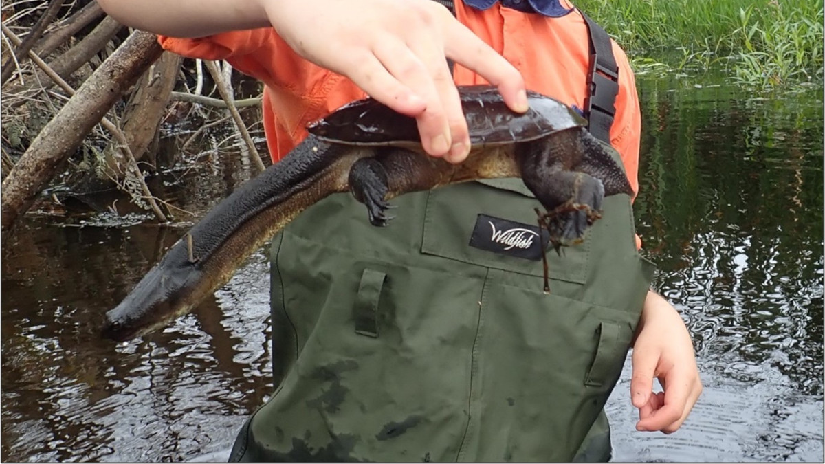
South-western snake-necked turtle at the Lower King Road site, March 2020
For more info on these and other aquatic species, please see the River Science fauna page here.
References and further reading:
Janicke S and Janicke G 2015, Yakamia Creek Living Stream Management Plan. Report prepared for the Oyster Harbour Catchment Group Inc.


