Image

Lower Vasse 1

Basin : Busselton Coast

Catchment : Vasse - Ludlow rivers

River condition at the Lower Vasse 1 site (site code: VR64VASS1, site reference: 6104082) on the Vasse River has been assessed as part of the Healthy Rivers program using standard methods from the South West Index of River Condition (SWIRC). The SWIRC incorporates field and desktop data from the site and from the broader catchment. Field data collected include the following indicators, assessed over about a 100 m length of stream:

  • Aquatic biota: fish and crayfish community information (abundance of native and exotic species across size classes, general reproductive and physical condition)
  • Water quality: dissolved oxygen, temperature, specific conductivity, and pH (logged in situ over 24 hours), as well as laboratory samples for colour, alkalinity, turbidity and nutrients
  • Aquatic habitat: e.g. water depth, substrate type, presence of woody debris and detritus, type and cover of macrophytes and draping vegetation
  • Physical form: channel morphology, bank slope and shape, bioconnectivity (barriers to migration of aquatic species), erosion and sedimentation
  • Fringing zone: width and length of vegetation cover within the river corridor and lands immediately adjacent, structural intactness of riparian and streamside vegetation
  • Hydrology: measures of flow (velocity) at representative locations (compared against data from stream gauging stations within the system)
  • Local land use: descriptions of local land use types and activities (compared against land use mapping information for the catchment)

The Vasse River 1 site was most recently assessed in March 2022. All known assessments are listed below:

  • 2022 – summer (March 14–15): Healthy Rivers
  • 2017 – spring (October 9–10): Healthy Rivers

Other data:
There are currently no monitored gauging stations on the Vasse River. However, the Vasse River – Outlet Diversion Drain gauging station (site reference: 610045), about 5 km upstream of the assessment site, was in operation from 2014 through to 2020. The gauging station is owned by Water Corporation.

Search the site code or site reference in the Department of Water and Environmental Regulation’s (the department) Water Information Reporting (WIR) system to find data for this site and nearby sampling points (flows, surface water quality, groundwater monitoring, department’s meteorological data). See also the Bureau of Meteorology website for additional meteorological data for the area.

Condition summary

The lower Vasse River is ephemeral (only flowing in winter months) and becomes disconnected during summer. Though the river is not tidal, it can experience periodic exchange with the estuarine environment. Elevated water temperatures, nutrient concentrations, and risk from related algae blooms through the dry season have been identified as some of the more significant and growing threats to ecosystem health. These conditions are a function of climate change (drying and warming climate trend), historical clearing and nutrient inputs associated with agriculture and urban land use through the catchment.

It should be noted that considerable effort is underway to improve health in the system and wider catchment under the Revitalising Geographe Waterways program, run by the multi-agency Vasse Taskforce.

Condition assessments to date have been carried out within the Noongar season of Bunuru (March) and Kambarang (October). Bunuru is generally the driest and hottest part of the year with little to no rain. Kambarang is the beginning of longer dry periods, where many of the plants and animals undergo transformations with the change in the warmer weather.

The October 2017 condition summary for this site is available via Revitalising Geographe Waterways.

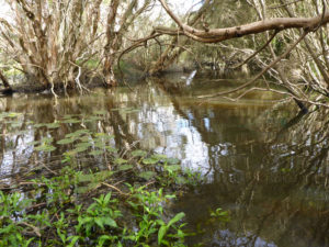
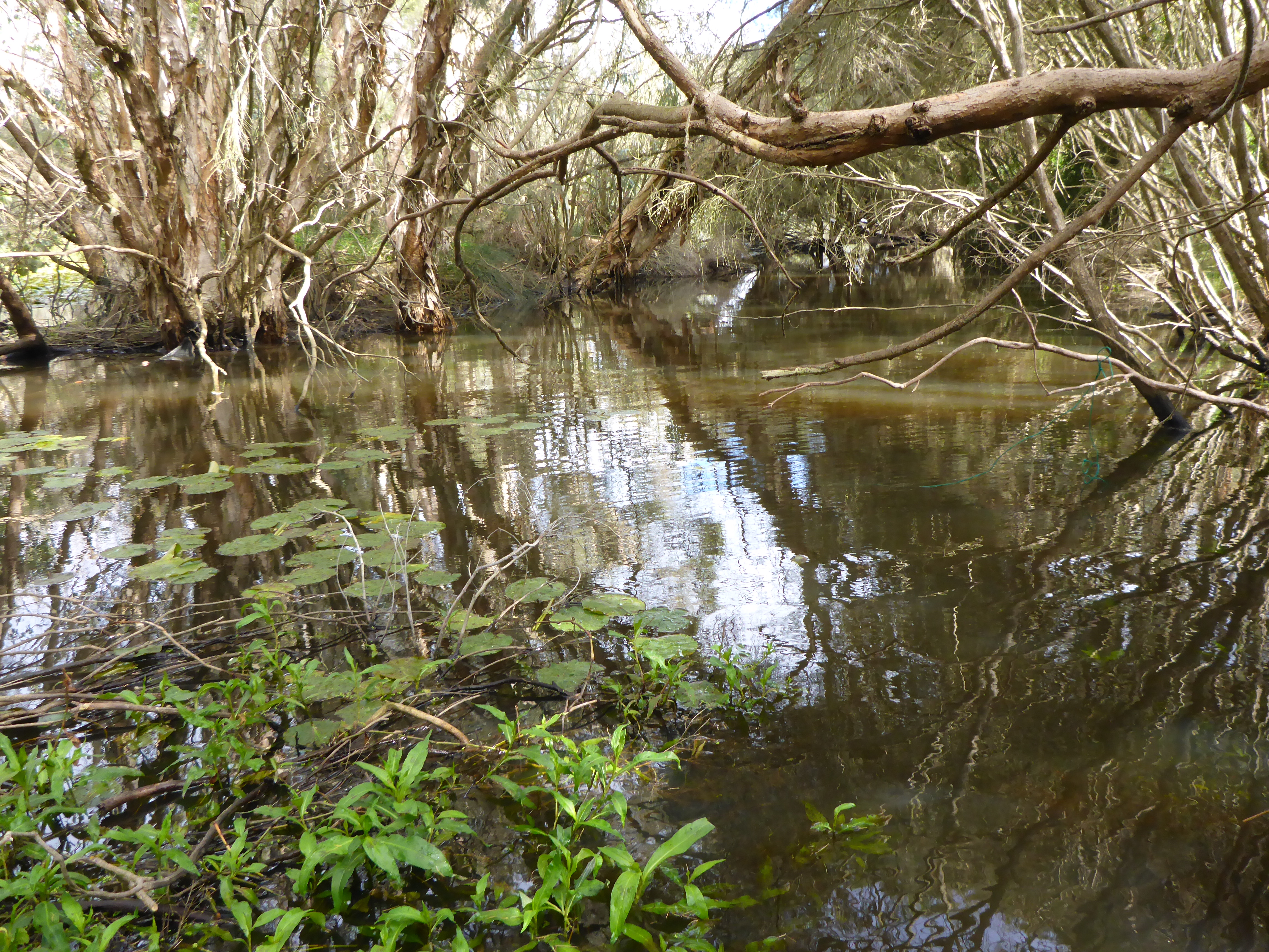
The images below represent conditions during the two Healthy Rivers assessments. Notably, water levels were not markedly different between the two seasons, with this section of the Vasse River retaining permanent, deep water. However, the March 2022 image highlights the significant algal bloom at that time (green colouration of water), which is not uncommon during the dry season. Further images of site conditions are provided in the gallery at the bottom of the page.

SPRING: VASSE RIVER, KAMBARANG (OCTOBER) 2017 AT LOWER VASSE RIVER 1

SUMMER: VASSE RIVER, BUNURU (MARCH) 2022 AT LOWER VASSE RIVER 1

A summary of aquatic habitat and biota from the different sampling events is provided in the sections below. For other site data please contact the department’s River Science team (please provide the site code and sampling dates).

Aquatic habitat

The site had poor to moderate structural aquatic habitat complexity, including a moderate cover of woody debris in two to three different sizes (<5–49 cm). Woody debris provides aquatic species shelter from aquatic and terrestrial predators as well as protection from fast flows.

Some habitat was provided by aquatic macrophytes and by branches and roots of streamside vegetation draped in the water. The coverage of draping vegetation was significantly less than would be expected under natural conditions, which is reflective of the reduced ground and shrub layer within the riparian zone. In addition to habitat, bank vegetation is needed for bank stability and shade.

The Mexican lily (Nymphaea mexicana) was present in both assessments. Although this macrophyte provides additional habitat and food resources for aquatic biota, it is an invasive weed species. The Mexican lily has been present in the Lower Vasse system since 2013, and infestations can negatively impact aquatic species through the loss of open water habitat. In October 2017 the invasive lilies covered more than half of the assessment site, occupying the whole channel is some sections. A decrease in coverage was observed in March 2022, with about 10 per cent of the assessment site covered. More information on the ecology of the Mexican lily and the impacts on water quality can be found via Revitalising Geographe Waterways:

The riverbed consisted mostly of sand and silt. The substrate had a moderate cover of organic material including algae, detritus, and leaves, which provides food for grazers and macroinvertebrates.

MEXICAN LILY AT LOWER VASSE RIVER 1 IN 2017 DURING KAMBARANG (OCTOBER)

MEXICAN LILY AT LOWER VASSE RIVER 1 IN 2022 DURING BUNURU (MARCH)

Species found at the site

Fish and crayfish

The species captured at the Lower Vasse 1 site during each of the sampling periods are provided in Table 1. The table includes a list of all species previously reported in the subcatchment, which provides an indication of species that may occur at the assessment site. As differences in habitat within a subcatchment naturally influence species distributions, and variability in methods between sampling programs can affect the species caught, this list is only indicative. Below are some of the notable findings from the assessments.

Six species of fish and crustacean were found at this site in March 2022. This includes one native freshwater fish (western pygmy perch), three native freshwater-estuarine species (blue-spot goby, south-western goby, sea mullet), one native freshwater crustacean (south-west glass shrimp) and one non-native fish (eastern gambusia).

The south-western snake-necked turtle (listed below in ‘Other aquatic fauna’) and eastern gambusia dominated the catch. This result is consistent with the high tolerance of both species to the known stressors in this part of the Vasse River system, particularly low dissolved oxygen related to high algal and bacterial productivity (because of high nutrient inputs and reduced flushing), as well as variable salinities because of tidal influence.

More information on water quality and current management plans for the Lower Vasse River can be found via Revitalising Geographe Waterways.

Four native species that were found in 2017 were not detected in 2020: two native freshwater fish (nightfish and western minnow), one freshwater-estuarine fish (western hardyhead) and one freshwater crayfish (gilgie). Most native freshwater fish of the South West are not able to tolerate saline waters, and the salinity was markedly higher during the time of sampling in March 2022 (low saline 6993 mg/L) compared to October 2017 (fresh 404 mg/L). Salinity levels in this part of the Vasse River are expected to naturally change between seasons and years, and this will affect species distributions. However, the lower reaches of the Vasse River are also known to be impacted by anthropogenic changes (modified water flow regime and connectivity; e.g. barriers to flow and fish movement) as well as reduced flushing because of a drying climate.

Note: the black-stripe minnow has been found in coastal wetland habitats within the wider subcatchment (Morgan & Beatty 2006); however, they do not typically occur within riverine habitats and therefore are not expected at this site.

Non-native goldfish are known to exist in the subcatchment but were not observed in the October 2017 and March 2022 sampling events. This does not suggest that the species are absent from the Lower Vasse 1 site, but it is a good indication that they are not present in significant numbers. Goldfish population control studies have taken place by Murdoch University in the Vasse River since 2003. Published papers can be found in the ‘References and further reading’ section below. Goldfish can be a significant threat to the Vasse River as they:

  • potentially encourage the growth of cyanobacteria as cells become activated as they pass through the digestive tract (Kolmakov and Gladyshev 2003; Morgan & Beatty 2007)
  • increase turbidity and resuspend nutrients available for algal uptake because of vigorous benthic foraging methods
  • compete for food and habitat with native fish, as well as predate on their eggs (Morgan & Beatty 2007).

Note: collection of fauna from inland aquatic ecosystems across Western Australia requires a licence from the Department of Primary Industries and Regional Development (DPIRD) and the Department of Biodiversity, Conservation and Attractions (DBCA). All species collected must be reported to these agencies as part of licence conditions.

Other aquatic fauna

Although not directly targeted as part of the Healthy Rivers assessment, the following species were recorded:

  • Carter’s freshwater mussel (Westralunio carteri) – listed as vulnerable under the Biodiversity Conservation Act 2016
  • south-western snake-necked turtle (Chelodina oblonga) – about 150 individuals recorded
  • water birds including yellow-billed spoonbill (Platalea flavipes), Australian white ibis (Threskiornis molucca)and Pacific black duck (Anas superciliosa).

Carter’s freshwater mussels were recorded at a density of about 10 individuals per metre squared within the first 3–4 m along both banks of the 100 m assessment site (numbers could not be assessed away from banks because of depth, but distribution is often limited to the shallower areas of rivers). The mussels were mostly within the channel; however, some were exposed on the banks (dead and alive). This species plays an important role in freshwater ecosystems as they filter sediments and pollutants (Beatty et al. 2017). More information on Carter’s freshwater mussels in the Lower Vasse River can be found below: