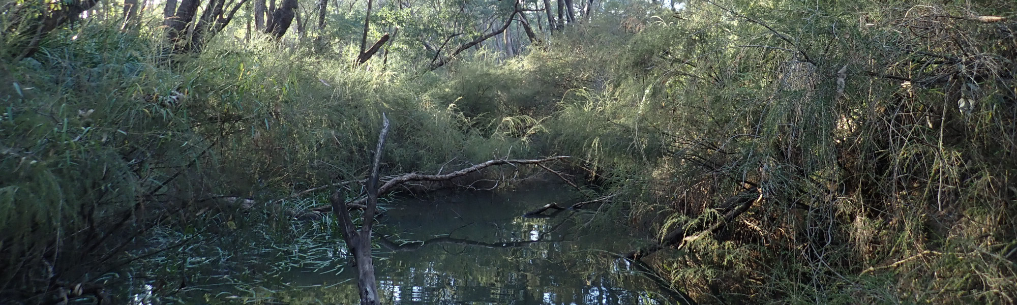
Serpentine River - Lowlands
Basin : Murray River
Catchment : Murray - Serpentine rivers
River condition at the Lowlands site (MR127SERP1), in the middle catchment of the Serpentine River was assessed as part of the Healthy Rivers Program (Healthy Rivers), using standard methods from the South West Index of River Condition (SWIRC).
Field data collected included the following indicators, assessed over about a 100 m length of stream:
- Aquatic biota: fish and crayfish community information (abundance of native and exotic species across size classes, general reproductive and physical condition)
- Water quality: dissolved oxygen, temperature, specific conductivity, and pH (logged in-situ over 24 hours) as well as laboratory samples for colour, alkalinity, turbidity and nutrients
- Aquatic habitat: e.g. water depth, substrate type, presence of woody debris and detritus, type and cover of macrophytes and draping vegetation
- Physical form: channel morphology, bank slope and shape, bioconnectivity (barriers to migration of aquatic species), erosion and sedimentation
- Fringing zone: width and length of vegetation cover within the river corridor and lands immediately adjacent, structural intactness of riparian and streamside vegetation
- Hydrology: measures of flow (velocity) at representative locations (compared against data from stream gauging stations within the system)
- Local land use: descriptions of local land use types and activities (compared against land use mapping information for the catchment)
Field data was collected by the river science team between 13 and 14 November 2017, and at this time no previous assessments of river ecology had been reported at this site. Murdoch University conducted two further assessments, during November 2019 and October 2020, on behalf of the Peel Harvey Catchment Council.
Condition summary
A summary of aquatic biota detected over the different sampling events is provided in the section below. For other site data, please contact the department’s River Science team (please reference the site code and sampling dates).
Species found in subcatchment
Native Species
Species found at the site
Fish and crayfish
Five fish species and two crayfish species were found at this site in 2017, including one exotic fish and one exotic crayfish species. The site was sampled again in 2019 and 2020 by Murdoch University and all results are included on Table 1 (see below).
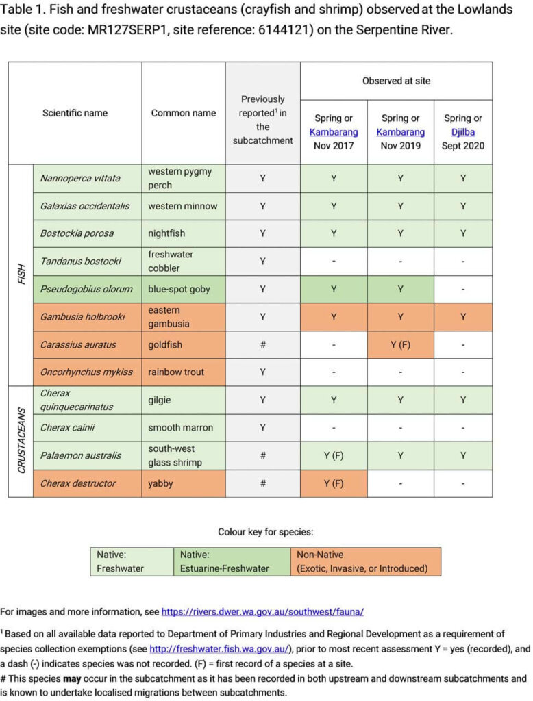
For full size table, click here.
Note: only fish and crayfish are targeted by sampling methods, however where other species were caught and/or observed they are included below.
Other aquatic fauna
One western long-necked turtle (Chelodina colliei) was found at this site.
Westralunio carteri (Carter’s freshwater mussel) was observed at the Lowlands site during the 2017–18 assessment. This mollusc is the sole endemic freshwater mussel species in WA and currently listed as vulnerable on the International Union for Conservation of Nature’s (IUCN) red list of threatened species, (due to declining range, which is largely attributed to the effects of salinity).


Explore other sites in the catchment
- Buchanans Drain
- Hotham River - Hotham River Nature Reserve
- Hotham River - Popanyinning
- Hotham River - Pumphreys Bridge
- Hotham River - Ranford Pool
- Lower Nambeelup Brook
- Lower Nambeelup Brook 2
- Lower Punrak Drain
- Lower Punrak Drain 2
- Murray-Marrinup Brook
- Serpentine River - Birriga Drain
- Serpentine River - Dog Hill
- Serpentine River - Downstream Peel Main Drain
- Serpentine River - Lowlands Road
- Serpentine River - Rapids Road
- Serpentine River - Ruperts
- Serpentine River - Summerfield Road
- Williams River - Boraning Reserve
- Williams River - Quindanning