Image

Preston River - Sylvan Way

Basin : Preston River

Catchment : Preston River

River condition of the Sylvan Way site (site code: PR2PRES1, site reference: 6114020), on the Preston River, was assessed between 14 and 15 February 2023. This was compared to a previous assessment in 2020.

Healthy Rivers assessments are conducted using standard methods from the South West Index of River Condition (SWIRC), which incorporates field and desktop data from the site and from the broader catchment. Field data collected include the following indicators, assessed over about a 100 m length of stream:

  • Aquatic biota: fish and crayfish community information (abundance of native and exotic species across size classes, general reproductive and physical condition)
  • Water quality: dissolved oxygen, temperature, specific conductivity, and pH (logged in situ over 24 hours) as well as laboratory samples for colour, alkalinity, turbidity and nutrients
  • Aquatic habitat: e.g. water depth, substrate type, presence of woody debris and detritus, type and cover of macrophytes and draping vegetation
  • Physical form: channel morphology, bank slope and shape, bioconnectivity (barriers to migration of aquatic species), erosion and sedimentation
  • Fringing zone: width and length of vegetation cover within the river corridor and lands immediately adjacent, structural intactness of riparian and streamside vegetation
  • Hydrology: measures of flow (velocity) at representative locations (compared against data from stream gauging stations within the system)
  • Local land use: descriptions of local land use types and activities (compared against land use mapping information for the catchment)

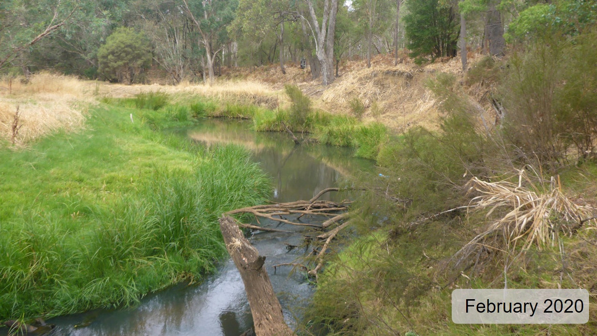
The site was previously assessed during February 2020.

Water quality loggers were deployed for an extended period (see below). This enabled assessment of water quality responses to changes in climate, streamflow and factors such as the intactness of vegetation within the river corridor. Among other things, this allows detection of potential suboptimal water quality conditions which can be missed during the standard 24-hour assessment.

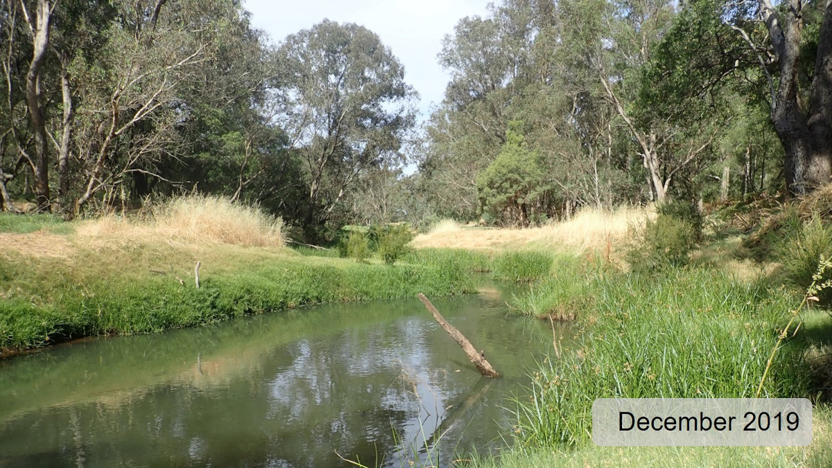
  • 2019–2020 (Dec–Apr): Healthy Rivers
  • 2022–2023 (Nov–Apr): Healthy Rivers

Other departmental data: The Sylvan Way site is about 1.5 km downstream of the Department of Water and Environmental Regulation’s (the department) flow gauging station on the Ferguson River known as SW Hwy Ferguson (site reference: 611007), which has been in operation since 1991. The site is also about 15 km downstream of the department's flow gauging station on the Preston River known as Boyanup Bridge (site reference: 611004), which has been in operation since 1980.

Search on the site code or site reference in the department's Water Information Reporting (WIR) system to find data for this site and nearby sampling points (flows, surface water quality, groundwater monitoring, the department's meteorological data).See also the Bureau of Meteorology website for additional meteorological data for the area.

Condition summary

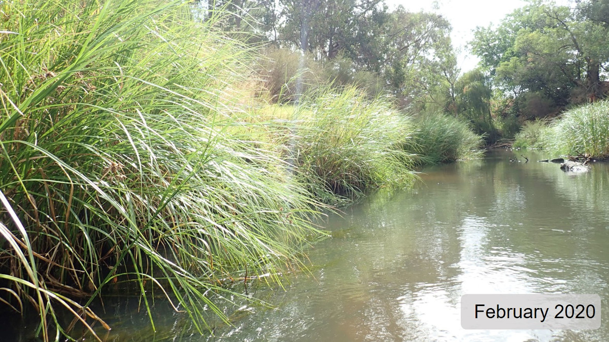
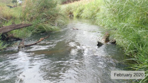
The image below indicates conditions at the Sylvan Way site during field work in February 2023. February is within the Noongar season of Bunuru or second summer, which is generally the hottest and often driest part of the year. These conditions may present periods of high stress for aquatic fauna. Further images are provided in the gallery at the bottom of the page to show general site conditions.
A summary of site condition over the latest monitoring period is provided in the sections below. For other site data, please contact the department’s River Science team (please reference the site code and sampling dates).

River setting

The Sylvan Way HRP site is on the lower reaches of the Preston River on the eastern outskirts of Bunbury, in the south-west of Western Australia.

The site is within a low-gradient section of meandering plane-bed channel within a broad river valley, typical of the coastal plain. The average width and depth of the wetted channel was 7–8 m and 1–1.5 m respectively at the time of sampling, although some areas were more than 2 m deep. Bankfull width was an average of 50 m and the approximate depth of the broader channel was 7–8 m.

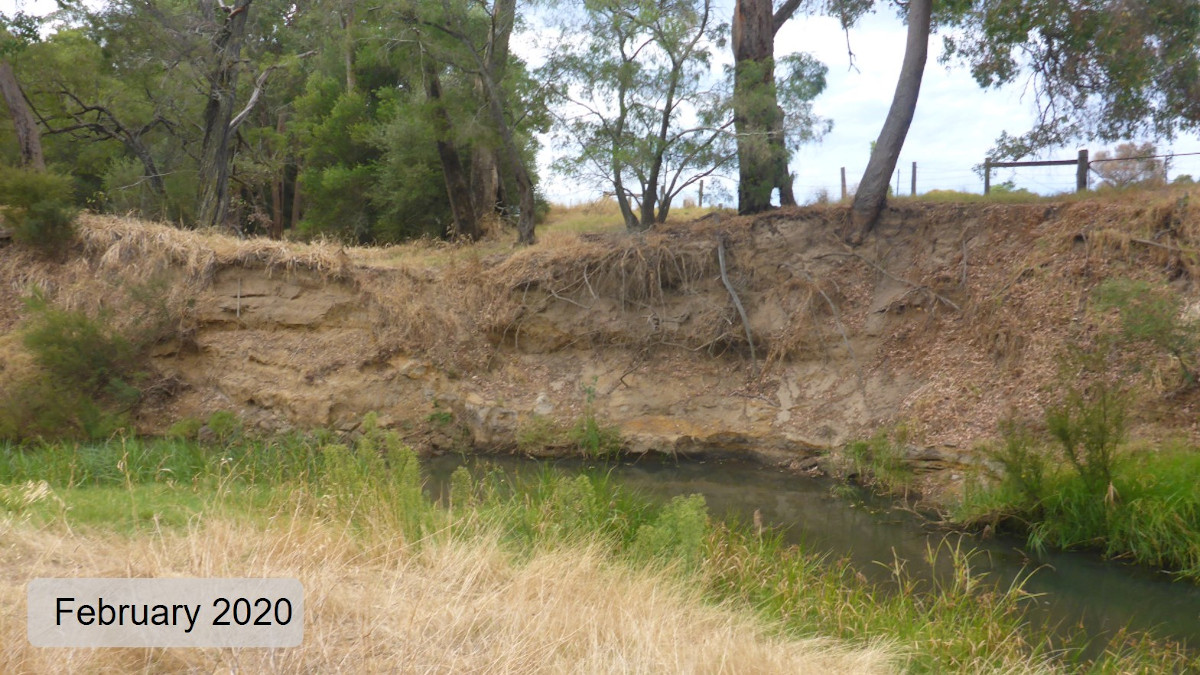
Generally, the banks were stepped and moderate to steep, but there was variation in bank shape and steepness including concave, vertical banks in areas of active erosion and wide lower bench sections of bank with moderate to low slope. The site was complex with great variety in channel path and width.

The effects of high winter flows through the site were evident in the shape of the channel and features through the adjacent zone. For example, there was a large anabranch in the adjacent zone on the left side of the channel. Some sections of severe erosion on the outsides of bends were further evidence of high flows.

Aquatic habitat

At the time of sampling the site was connected channel habitat.

The aquatic habitat was varied. The most noticeable feature was the extensive sedimentation which reduced substrate diversity and habitat for aquatic fauna. The substrate was mostly coarse sand with a little gravel; about 10 per cent of the sandy substrate was covered with filamentous algae.

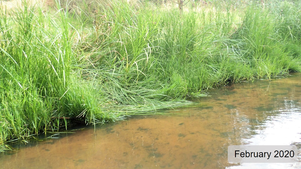
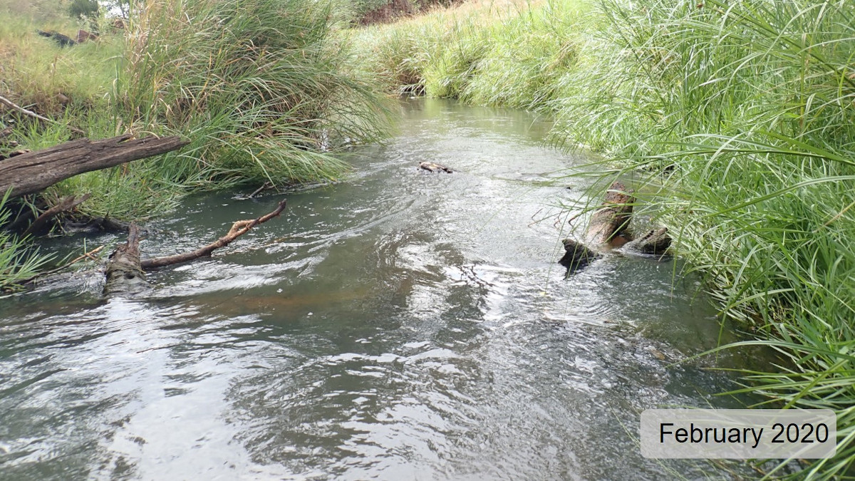
The banks were lined with Cyperacae spp. (see image below), a sedge that provided habitat and some shading along most of both banks (50–74 per cent) and about 20 per cent of the channel width. Woody debris was near optimal with a variety of sizes of wood observed in moderate abundance through the site. Biological substrate cover (algae, epiphytes, detritus and leaves) was extensive through the site (60–100 per cent) but the density of cover was relatively sparse.

Overhanging roots and overhanging banks provided habitat along 10–49 per cent of the bank length. Bank vegetation draped in the water (mostly Cyperacae, but also some Melaleuca spp. [tea tree] and terrestrial grasses) provided habitat for along 50–100 per cent of the bank length.

The streamside tree canopy shaded between 55–60 per cent of the bank length and extended about 4 m over the river from the banks. Many of the taller shading trees, mostly Eucalyptus rudis (flooded gum), were set back from the river, possibly because of the high winter flows which hinders recruitment of new trees in the area. One dense stand of exotic Salix spp. (willow), close to the banks in the middle of the site, provided shade across the whole river.

Flow & connectivity

The Preston River is a perennial system along much of its length because of water releases from Glen Mervyn Dam for the Preston Valley Irrigation Cooperative, as well as from a net input of groundwater from the superficial aquifer to the west of the Darling Scarp on the coastal plain (Department of Water 2015, unpublished). There is also input of more saline water from the Ferguson River which carries saltier water from the Collie River for irrigation in the Ferguson valley catchment (via the Burekup irrigation channels). The Collie catchment has experienced secondary salinisation following large-scale clearing for mining and agriculture.

At the time of the assessment, the site was connected and flowing. The department’s flow gauging station at Boyanup Bridge (614004) – 15 km upstream of the site – measured a total daily discharge of 10.7 ML/day during the field assessment. The minimum daily discharge recorded at that station during the period the long-term water quality logger was deployed was 8 ML on 22 January 2023. The top graph in the water quality section (below) shows the difference in flows in the Preston River (611004) and the Ferguson River (611007).

The flow is more variable in the Ferguson River than in the Preston River and this apparent in the plot of specific conductivity (bottom of the three graphs in the water quality section), which reflects the input of more saline water from the Collie River.

Vegetation

The riparian zone (containing species adapted to living at the interface between aquatic and terrestrial environments) was between 5–35 m wide on the right bank and extended more than 50 m from the river on the left bank. Riparian species including Melaleuca spp. (paperbarks) and stands of reeds were observed past the fence line, in the paddock adjacent to the left bank. This extended more than 50 m from the riverbank in some places. In November 2022, when the long-term water quality logger was deployed, water was observed in depressions in the paddock. This is assumed to be residual water from inundation of the adjacent zone during the previous winter (see below).

A mature canopy of large trees, mostly flooded gum (with some paperbarks and peppermint trees), was present, though set back from the river in places, so shading was not optimal. Both the shrub layer and ground layer were reduced, most likely by human influence (e.g. past clearing and occasional stock access to the river corridor). Native species included tea tree, bracken and various rushes and sedges (including Cyperacae)Moderate amounts of natural recruitment of both trees and shrubs were observed at the site. Exotic species included willow, buffalo grass and Watsonia (bugle lily). Watsonia was abundant through much of the site, on the left bank especially.

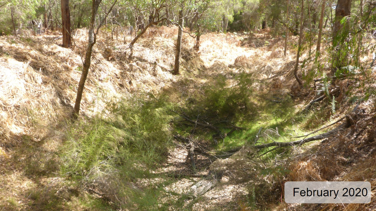
Channel stability was varied, with some areas of significant erosion observed. The right bank was affected to a greater degree than the left bank, with 20–49 per cent of the length affected, and the severity of erosion rated as high, indicating poor bank stability (see image below).

The left bank was affected by erosion along 0–4 per cent of its length. It was rated as having good structural integrity, indicating it was relatively stable.

Water quality

Below is a graph of the long-term water quality recorded at the Sylvan Way site from November 2022 to April 2023.

Water temperatures were near optimal. The upper temperature threshold1 of 25°C was only exceeded for 3.2 per cent of the deployed period, and only for a short duration when it was exceeded. The diurnal range in water temperature was optimal (<4°C).

Water quality was optimal in terms of dissolved oxygen. Dissolved oxygen concentrations only fell below the low threshold2 of 4 mg/L for 0.17 per cent of the deployed period. The diurnal range in dissolved oxygen was variable. The range was suboptimal (exceeded 4 mg/L in a 24-hour period) from early December 2022 to early January 2023 but was generally optimal (<4 mg/L) at all other times. The reason for this improvement in diurnal flux in dissolved oxygen is not immediately apparent but it does coincide with an increase in flows in the Ferguson River (gauging station 611007). It is possible the greater flows that would have resulted at Sylvan Way aerated water as it flowed through riffles and snags of woody debris, maintaining a more optimal diurnal range and reducing the influence of any biological drivers of dissolved oxygen.

In general, considering that that the logger was not in a well shaded section of the river (1–9 per cent canopy cover overhead), the optimal water quality observed is likely supported by the strong baseflow through summer months, when many systems would be experiencing much slower, or no, flows.

Specific conductivity (which can be used as an indicator of salinity) was generally optimal, but the more saline water from the Ferguson River (via irrigation water sourced from the Collie River catchment) impacted the site, resulting in fluctuating salinity over the November 2022 to April 2023 period. Specific conductivity varied between 0.72 mS/cm to 2.1 mS/cm, which covers a range of salinity from fresh to marginal-brackish. While this level of salinity is not expected to exert particularly high stress on fish and crayfish species, it is expected to affect more sensitive freshwater invertebrate taxa (water bugs).

pH was largely within acceptable ranges (although towards the lower end of the range of 6.5–8.0), based on expectations of natural ranges for freshwater rivers of south-west Western Australia.

This long-term water quality was consistent with the water quality during the 2019–2020 assessment. This is encouraging and still appears to be largely supported by (and therefore likely dependent upon) the strong baseflow observed through summer and autumn during both assessments.

Nutrient concentrations (total nitrogen and total phosphorus) were both classed as low and considered optimal. Turbidity was moderate (8.1 nephelometric turbidity units [NTU]) and true colour was 19 true colour units (TCU) which is relatively uncoloured and generally matches the field observations of ‘slight’ tannin staining.

There is a small gap in the data as the probe did not log data for a period during February 2023.


Footnote:

1 An upper limit for temperature is nominally set at 25°C based on the range recorded in sites where south-west native fish species are typically found to occur (Beatty et al. 2013).

2 A lower limit of 4 mg/L is taken from the SWIRC where it is used as a guideline limit for condition scoring. This level aligns with Beatty et al. (2013) where south-west native fish species were shown to typically reside in sites with levels above 4 mg/L.

Species found in subcatchment

This includes all species found within the subcatchment of the assessment site, from this and previous studies in the area. The photos are linked to more information about each species, including maps of where they are expected across the south-west.

Species found at the site

Fish and crayfish

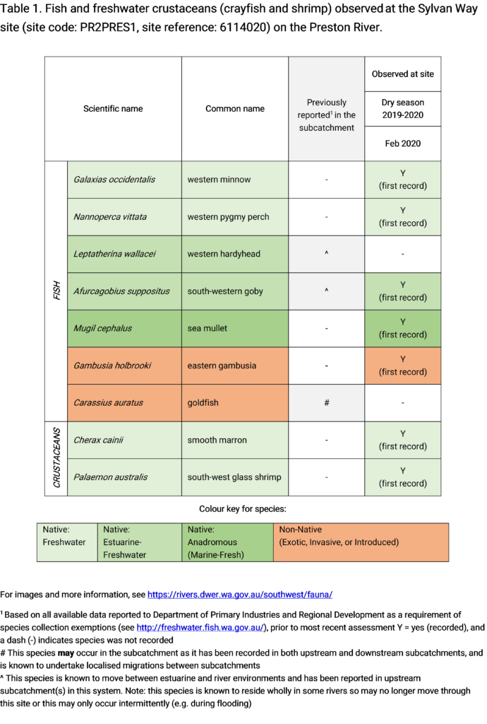
The species recorded at the Sylvan Way site in 2023 are provided in the table below. The table includes a list of all species previously reported in the subcatchment, which provides an indication of species that may occur at the assessment site. As differences in habitat within a subcatchment naturally influence species distributions, and variability in methods between sampling programs can affect the species caught, this list is only indicative.

Nine species of fish and two species of crustacean were recorded during the 2023 sampling, which is an increase in diversity from 2020 when five species of fish and two species of crustacean were recorded. The aquatic fauna observed in 2023 included all four commonly found native freshwater fish species (western minnow, freshwater cobbler, western pygmy perch and nightfish) as well as three estuarine opportunistic species (south-western goby, western hardyhead and blue-spot goby) and one predominantly marine-estuarine species (sea mullet). This increase in recorded species diversity is likely a reflection of increased sampling effort (i.e. it is the combined observations of two sampling efforts – 2020 and 2023). But it highlights the importance of repeated assessments over the long term to see a more comprehensive picture of the aquatic fauna, which can be highly mobile.

The only exotic fish species recorded was the eastern gambusia which were only observed during the assessment and not recorded in any nets or traps. This suggests abundance was low (as it was in 2020 when only 26 individuals were recorded), which is encouraging as it suggests the population may not be well established, which would present less risk to native fish species.

While species diversity had increased from the 2020 assessment, the total abundance was similar and relatively low, which is at odds with a relatively healthy species diversity. The presence of estuarine-marine and estuarine-freshwater opportunistic species (mullet, western hardyhead, south-western goby and blue-spot goby) indicates these species are using the strong baseflow to move further upstream while conditions are favourable. It is possible that this is just a function of natural movements through the connected system or that there are areas of the river nearby that provide more preferred habitats.

Note: collection of fauna from inland aquatic ecosystems across Western Australia requires a licence from the Department of Primary Industries and Regional Development (DPIRD) and the Department of Biodiversity, Conservation and Attractions (DBCA). All species collected must be reported to these agencies as part of licence conditions.

Other aquatic fauna

Only freshwater fish and crayfish that typically inhabit river channels are targeted by the standard SWIRC sampling methods; however, other species are sometimes captured or observed. The following species were detected at the site:

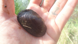
  • Carter’s freshwater mussel (Westralunio carteri) was visually observed during the water quality logger deployment in November 2022. This mollusc is the sole endemic freshwater mussel species in Western Australia and is currently listed as vulnerable on the International Union for Conservation of Nature’s (IUCN) red list of threatened species (because of declining range, which is largely attributed to the effects of salinity).
For more information on these and other aquatic species, please see the River Science fauna page.