Denmark River - Settlers Road
Basin : Denmark Coast
Catchment : Hay - Denmark rivers
River condition at the Settlers Road site (site code: HD28DENM1, site reference: 6031574) on the Denmark River was assessed in March 2020 as part of the Healthy Rivers Program (Healthy Rivers), using standard methods from the South West Index of River Condition (SWIRC). The SWIRC incorporates field and desktop data from the site and from the broader catchment. Field data collected include the following indicators, assessed over approximately a 100 m length of stream:
- Aquatic biota: fish and crayfish community information (abundance of native and exotic species across size classes, general reproductive and physical condition) and macroinvertebrates
- Water quality: dissolved oxygen, temperature, specific conductivity, and pH (logged in-situ over 24 hours), as well as laboratory samples for colour, alkalinity, turbidity and nutrients
- Aquatic habitat: e.g. water depth, substrate type, presence of woody debris and detritus, type and cover of macrophytes and draping vegetation
- Physical form: channel morphology, bank slope and shape, bioconnectivity (barriers to migration of aquatic species), erosion and sedimentation
- Fringing zone: width and length of vegetation cover within the river corridor and lands immediately adjacent, structural intactness of riparian and streamside vegetation
- Hydrology: measures of flow (velocity) at representative locations (compared against data from stream gauging stations within the system)
- Local land use: descriptions of local land use types and activities (compared against land use mapping information for the catchment)
This is the first assessment of this site using the SWIRC methods. At this time no previous assessments of river ecology had been reported.
Assessments are listed below:
- 2020 – summer (16–17 Mar): Healthy Rivers
Other department data: The river health site is approximately 5.3 km upstream of the departments Denmark Ag College gauging station (site reference: 603021), which has been in operation since 1997.
Search on the site code or site reference in the Department of Water and Environmental Regulation’s Water Information Reporting (WIR) system to find data for this site and nearby sampling points (flows, surface water quality, groundwater monitoring, the department's meteorological data). See also the Bureau of Meteorology website for additional meteorological data for the area.
Condition summary
A complete condition summary for this site has not yet been published. Please contact the department’s River Science team for site data (please provide the site code and sampling dates).
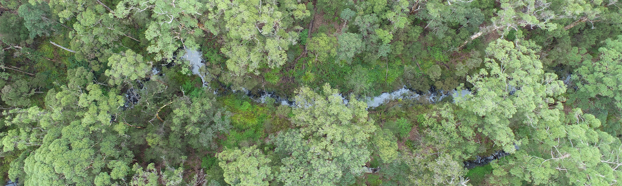
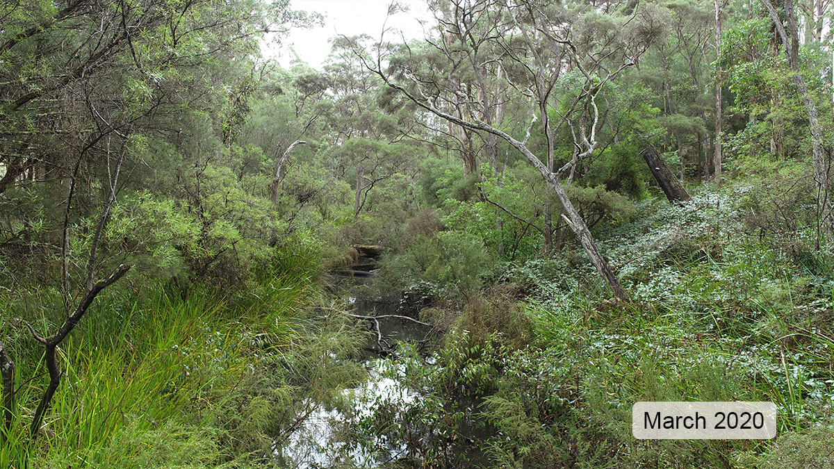
The image below indicates conditions at the time of sampling in March, towards the end of the dry season. March is within the Noongar season of Bunuru, which is generally the driest and hottest part of the year. Further images are provided in the gallery at the bottom of the page to show general site conditions.
An overview of aquatic species found at the site is provided in the next section.
Species found in subcatchment
Native Species
Exotic Species
Species found at the site
Fish and crayfish
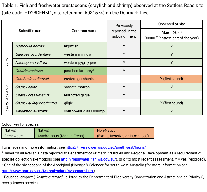
Seven species were recorded at this site in the March 2020 assessments. This includes three endemic* native fish (nightfish, western minnow, western pygmy perch), three endemic* native crustaceans (smooth marron, gilgie and south-west glass shrimp), and one non-native fish (eastern gambusia).
* these species are ‘endemic’ to south-west Western Australia, which means they are found nowhere else in the world (unless introduced).
The fish and crayfish population at this site was dominated by native freshwater fish and although this is the first record of the invasive eastern gambusia, they were in low abundance.
The restricted gilgie was not recorded in this assessment but may be present elsewhere in the catchment. This species was recorded at a site further downstream in 2009 (see Howe Road site).
Although not recorded in this sampling event, pouched lamprey are known to occur in the area. The last known record was in 2007 (Close et al., 2008) where juvenile lamprey (ammocetes) were recorded. Lamprey are not often encountered given their short migration periods between the ocean and river (which generally occur in peak flows) and the juveniles have a prolonged sedentary larval phase where they burrow in to river beds and filter-feed for up to four years before returning to the ocean.
Pouched lamprey are categorised as Priority 3 species (Poorly-known) under the Biodiversity Conservation Act 2016 (Western Australia). Priority 3 refers to possibly threatened species where data is insufficient to assess threatening processes that could affect them, also noting that this species is not expected to be under imminent threat based on available data.
Only fish and freshwater crustaceans (crayfish and shrimp) that typically inhabit river channels are targeted by the standard SWIRC sampling methods. However, where other species were caught and/or observed (e.g., turtles, rakali-native water rats, tadpoles), these are mentioned in the Other aquatic fauna section below.
Note: collection of fauna from inland aquatic ecosystems across Western Australia requires a license from the Department of Primary Industries and Regional Development (DPIRD) and also the Department of Biodiversity, Conservation and Attractions (DBCA). All species collected must be reported to these agencies as part of license conditions.
Aquatic macroinvertebrates
Macroinvertebrate sampling occurred during the March 2020 assessments. Please contact the department’s River Science team for site data (please provide the site code and sampling dates).
Other aquatic fauna
Although not targeted by collection methods a motorbike frog (Litoria moorei) was recorded during March 2020 assessments.
For more information on aquatic species, please see the River Science fauna page here.
References & recommended reading


Explore other sites in the catchment
- Cleerilliup Creek - Bevan Road
- Denmark River - Amarilup Road
- Denmark River - Churchill Road
- Denmark River - Granite Road
- Denmark River - Howe Road
- Denmark River - Riverbend Lane
- Hay River
- Hay River - Historical Weir Ruin
- Mitchell River - Denmark Mt Barker Road
- Quickup River - Powleys Road
- Sheepwash Creek
- Sleeman Creek