Serpentine River - Downstream Peel Main Drain
Basin : Murray River
Catchment : Murray - Serpentine rivers
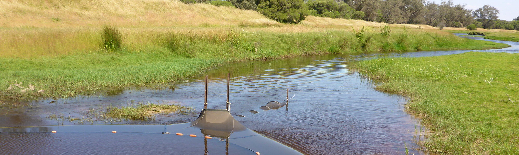
The condition of the Serpentine Downstream Peel Main Drain site (MR83SERP1), was assessed between 13 and 14 November 2017, over a 100-m length of stream. This site is situated in the lower catchment of the Serpentine River.
The assessment was conducted using standard methods from the South West Index of River Condition. Measures chosen for this assessment included fish and crayfish, aquatic habitat, water quality (dissolved oxygen, temperature, electrical conductivity, and pH logged every 30 minutes between 13 November 2017 and 17 May 2018 and colour, alkalinity, turbidity and nutrients), fringing vegetation, channel morphology, erosion, connectivity, local land use and flow. Note: No logged water quality data is available between 15 December 2017 and 26 February 2018.
Condition summary
An online condition summary for this site has not been prepared. Please contact the department’s River Science team for site information, and see below for links to information on some of the species found at the site, and some images taken in 2017.
Fish and crayfish
As this was the first time this site had been sampled using SWIRC methods, the species expected to occur here (listed below) are based on species reported from studies conducted elsewhere in the catchment. As differences in habitat within a reach naturally influence species distributions, and variability in methods between sampling programs can affect the species caught, so this list is only indicative.
8 fish species and 4 species of crustacean were found at this site in 2017, including 8 native species and 4 exotic species, see Table 1, below, for details.
A list of species is provided at the bottom of the page, click on the images to learn more about each species.
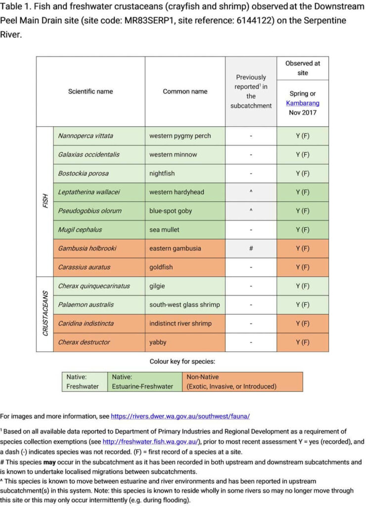
Click here for full size table
Only fish and freshwater crustaceans (crayfish and shrimp) that typically inhabit river channels are targeted by the standard SWIRC sampling methods.
Note: collection of fauna from WA’s inland aquatic ecosystems requires a license from the Department of Primary Industries and Regional Development (DPIRD) and also the Department of Biodiversity, Conservation and Attractions (DBCA). All species collected must be reported to these agencies as part of license conditions.
Species found in subcatchment
Native Species
Other aquatic fauna
One western long-necked turtle (Chelodina colliei) were also caught at this site.


Explore other sites in the catchment
- Buchanans Drain
- Hotham River - Hotham River Nature Reserve
- Hotham River - Popanyinning
- Hotham River - Pumphreys Bridge
- Hotham River - Ranford Pool
- Lower Nambeelup Brook
- Lower Nambeelup Brook 2
- Lower Punrak Drain
- Lower Punrak Drain 2
- Murray-Marrinup Brook
- Serpentine River - Birriga Drain
- Serpentine River - Dog Hill
- Serpentine River - Lowlands
- Serpentine River - Lowlands Road
- Serpentine River - Rapids Road
- Serpentine River - Ruperts
- Serpentine River - Summerfield Road
- Williams River - Boraning Reserve
- Williams River - Quindanning